Disclosure : This site contains affiliate links to products. We may receive a commission for purchases made through these links.
Montenegro Wilderness Biking Atlas
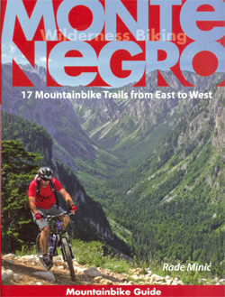
Montenegro Wilderness Biking Atlas compiled by Map Solutions and the country’s National Tourism Organization, with detailed topographic mapping at 1:100,000 overprinted with 17 cycling routes from eight centres. The trails vary in length from 41km to 178km and can be combined into longer routes or circuits.The atlas, published in a handy A5 spiral-bound format, presents routes from eight locations: Podgorica, Niksic, Kolasin, Rozaje, Zabljak, Mojkovac, Bijelo Polje and Herceg Novi. The routes are overprinted on detailed topographic survey maps at 1:100,000 and cross-referenced at various important points to instructions giving distance, timing, speed, slope and elevation, plus a diagram indicating direction accompanied by a photo of the terrain and brief instructions.Each route is also provided with a general description of the terrain, details of its length total and climb, difficulty and road surface, an elevation profile, information on accommodation, eating places and shops/markets, tourist offices, etc. Also included is a separate folded map of the country showing all the trails and how they can be combined into longer routes or circuits. On the reverse is a summary of each route with its essential details.*All the text is in English.*


