Disclosure : This site contains affiliate links to products. We may receive a commission for purchases made through these links.
Nevado Ojos del Salado Alpenverein 0/13

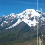
Detailed topographic survey map of Nevado Ojos del Salado, showing both the Chilean and the Argentinian side of the mountain. The map was compiled from satellite imagery and various Argentinian and Chilean sources by the Austrian Alpine Club and updated in 2004. Contours at 50m intervals, spot heights and hill shading are used to show the relief. Major peaks, valleys, glaciers, etc. are all named. The map has a great deal of terrain detail e.g. cliffs, morain, scree, etc.Roads and tracks leading to the main approaches to the mountain and other nearby peaks are shown only on the Chilean side. Main trekking and climbing routes are marked on both sides of the border. An inset shows the peak of Nevado Ojos de Salado at 1:35,000 with contours at 25mLatitude and longitude margin ticks are at 5` intervals and a UTM grid is drawn on the map. Map legend includes English.


