Disclosure : This site contains affiliate links to products. We may receive a commission for purchases made through these links.
Roman Border (Limes) in Hesse: Holzhausen an der Haide to Saalburg
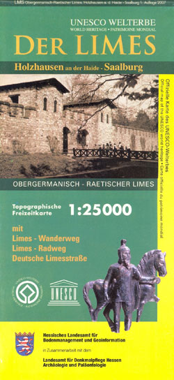
Hiking and cycling route along the ancient limes, the Upper Germanic-Rhaetian boundary of the Roman Empire, on a detailed, GPS compatible topographic map at 1:25,000 from the state survey of Hesse, covering the section from Holzhausen an der Haide to Saalburg.The route along the limes, one of the outstanding archaeological monuments in Central Europe and a UNESCO World Heritage site, is shown on cartography of the German topographic survey at 1:25,000 with contour lines at 10m intervals, relief shading, plus colouring and/or graphics for woodlands, vineyards, etc, including all the details expected of topographic mapping at this scale. An overprint indicates the hiking route, the cycle version, plus the course of the Deutsche Limesstraรe tourist route along the local roads. Also marked are numerous other local hiking, cycling trails and sightseeing trails. Symbols mark locations of existing or no longer visible Roman sites along the route, as well as tourist facilities such as campsites and youth hostels, places to eat, barbeque and picnic sites, car parks, viewpoints, etc. The map has a 1km UTM grid.Also provided are notes about the Roman border, illustrated with colour photos. Map legend and all the accompanying text include English.

Related Products:
 Roman Border (Limes) Cycle Route: the Rhine to the Danube (816km) Bikeline Map/Guide
 Germany: Hesse 50K Topographic Survey Leisure Maps
 German Limes Cycle Route – Bad Hรถnningen to Passau Bikeline Map-Guide Compact
 Kassel – North Hesse Cycling Map
 Rhine-Main – North Hesse Cycling Map 16
 Germany: Baden-Wรผrttemberg 50K Topographic Survey Leisure Maps
 Hayange – Villerupt – Audun-le-Roman IGN 3311SB
Roman Cycle Route along the Lippe – Teutoburg Forest to the Rhine Bikeline Map-Guide
Hayange – Villerupt – Audun-le-Roman IGN 3311SB
Roman Cycle Route along the Lippe – Teutoburg Forest to the Rhine Bikeline Map-Guide
 Strandzha Mountains: Burgas to the Turkish Border Domino Map
 The Roman Way
 Vlora and Environs
 Bled Pocket Map
Vermoshi – Tamare – Razma – Thethi
Bled Pocket Map
Vermoshi – Tamare – Razma – Thethi
 Germany: Rhineland-Palatinate 50K Topographic Survey Recreational Maps
 Triglav Pocket Map
 Korรงa and Environs
 Puka and Environs
 Elbasan – Berat
 Saranda and Environs
 Roman Britain OS Map
 Shkodra and Environs
 Saar-Hunsrรผck Nature Park East
 El Collsacabra
 Tirana – Durrรซs – Kruja
 Roman Britain and Where to Find It
 El Ports 2-map Set
 Hesse Marco Polo Regional Map 6
 Massif des Ecrins – Oisans – Champsaur IGN 75006
 Baltic Coast Coast – Lubeck to the Danish Border 2-Map Set Kompass 724
 North Rhine-Westphalia Central/South – Hesse Northwest 2-Map Cycling Set Kompass 3706
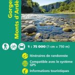 Gorges and Monts d`Ardรจche IGN 75014
 Picos de Europa National Park 3-Map and Guide Set CNIG ENGLISH
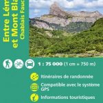 Lake Geneva and Mont Blanc IGN 75007
 France: IGN 75K/25K TOP75 Recreational Maps
 El Ports: Southern Stars Long-distance Hiking Route
 Tropoja – B. Curri – Valbona
 Picos de Europa National Park 3-Map and Guide Set CNIG SPANISH
 Mรกtra Cartographia Tourist Map 14
 Kurhessisches Bergland