Disclosure : This site contains affiliate links to products. We may receive a commission for purchases made through these links.
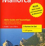
Mallorca West Reise Know-How
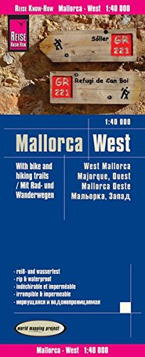
Western Mallorca at 1:40,000 in a series of four GPS compatible, double-sided maps from Reise Know-How printed on light, waterproof and tear-resistant synthetic paper, with very clear presentation of the road network, plus selected hiking and cycling routes.Maps in this series have contours at 100m intervals, enhanced by altitude colouring, with plenty of names of mountain ranges, peaks, etc. Road network includes local roads and cart tracks; driving distances are shown on main and selected secondary routes. A wide range of symbols highlight various places of interest, including campsites and mountain shelters, archaeological and historical sites, viewpoints, beaches and surfing/diving sites, botanical gardens, etc.For hikers the maps show hiking trails indicating easy, moderate or difficult routes. Also highlighted are recommended cycling routes, with the maps indicating roads closed to cyclists. Each map is double-sided, indexed, and has both a UTM and a latitude/longitude (interval 2’) grid. Map legend includes English.To see the other titles in this series please click on the series link.

Related Products:
 Mallorca East Reise Know-How
 Mallorca South Reise Know-How
 Mallorca North Reise Know-How
Spain: Reise Know-How Walking and Touring Maps of Mallorca
Mallorca North Reise Know-How
Spain: Reise Know-How Walking and Touring Maps of Mallorca
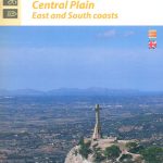 Mallorca Central Plain – East and South Coasts Editorial Alpina
 Mallorca F&B 2-Map Set
 Mallorca F&B
 Canada West Reise Know-How
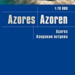 Azores Reise Know-How
 Mallorca Editorial Alpina Cycling Map
 Turkey Reise Know-How
 Africa West – Sahara Reise Know-How
 Mallorca North Walking & Cycling Map & Guide Editorial Alpina
 Australia West Reise Know-How
 Mallorca K+F Outdoor Map
 Africa West – Coastal Countries Reise Know-How
 Mallorca 4-Map Set Kompass 2230
 Russia West Reise Know-How
 Finland West Karttakeskus Outdoor Road Map
 Skane South-West Cycling Map 1
 China West Reise Know-How
 Drenthe West Cycling Map
 Hawaii Reise Know-How
 Westhoek – South-West Flanders Falkplan Cycling Map 34
 Algarve Reise Know-How
 West Frisian Islands Falkplan Cycling Map
 Sweden South Reise Know-How
Brabant West and Central Cycling Map
Sweden South Reise Know-How
Brabant West and Central Cycling Map
 Nicaragua – Honduras – El Salvador Reise Know-How
 Uganda Reise Know-How
 Poland Reise Know-How
 Myanmar / Burma Reise Know-How
 Slovenia Reise Know-How
 Mallorca Kompass 2-Map Cycling Set 3500
 Albania Reise Know-How
 Estonia Reise Know-How
 South Africa Reise Know-How
Mallorca Publicpress Cycle Touring 152
South Africa Reise Know-How
Mallorca Publicpress Cycle Touring 152
 Caps del Nord – Mallorca Editorial Alpina 2-Map Set
South-Holland North – Green Heart West and Bollenstreek Falkplan Cycling Map 14
Caps del Nord – Mallorca Editorial Alpina 2-Map Set
South-Holland North – Green Heart West and Bollenstreek Falkplan Cycling Map 14