Disclosure : This site contains affiliate links to products. We may receive a commission for purchases made through these links.
Poland Southwest Reise Know-How
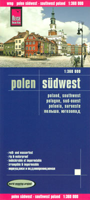
South-Western Poland at 1:360,000 on indexed, double-sided, waterproof and tear-resistant touring map from Reise-Know-How with historical names of main towns and other important locations which during the 19th and part of the 20th century were in Germany or in the Austro-Hungarian Empire. Coverage extends eastwards to Torun in the north-eastern corner of the map, and in the southern part of the map to Czestochowa, Katowice and Auschwitz.Road network is easy to see on a clear base which shows topography by altitude colouring with contours and spot heights, plus boundaries of national parks and other protected areas. Road network includes selected unsurfaced local roads and tracks, indicates locations of border crossings and shows driving distances on main and secondary roads. Railway lines are included and local airports are marked. Internal administrative boundaries are shown with names of the provinces. Symbols highlight various places of interest, including campsites, castles, churches, viewpoints, etc. The map has latitude and longitude lines at intervals of 30’ and an index of place names. Map legend includes English.To see the other titles in this series please click on the series link.

Related Products:
 Poland Southeast Reise Know-How
 Poland: Reise-Know-How Touring Maps with Historic Place Names
 Poland 700K F&B
 Poland North
 Poland South
 Ireland Reise Know-How
 Armenia Reise Know-How
 Poland Road Map
 Romania – Moldova Reise Know-How
 Norway South Reise Know-How
 Azerbaijan Reise Know-How
 Poland 500K F&B
 Poland: Michelin Regional Road Maps
 Belarus F&B
 Albania Reise Know-How
 Portugal Reise Know-How
 Poland Reise Know-How
 Indochina: Vietnam – Laos – Cambodia Reise Know-How
 Poland Michelin
 Afghanistan F&B
 Ecuador – Galapagos Islands Reise Know-How
 Jordan Reise Know-How
 Guatemala – Belize Reise Know-How
 Macedonia Road Map
 Bosnia-Herzegovina – Montenegro Reise Know-How
Poland North Reise Know-How
Bosnia-Herzegovina – Montenegro Reise Know-How
Poland North Reise Know-How
 Pyrenees Reise Know-How
 Poland: Carta Blanca/Kompas Road Atlas 2015 GLOVEBOX, SPIRAL-BOUND
 Philippines Reise Know-How
 USA Southwest Reise Know-How
 Sri Lanka Reise Know-How
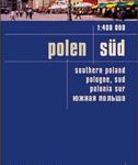 Poland South Reise Know-How
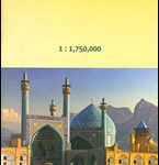
 Iran Reise Know-How
 France Southwest Michelin
 Poland South West Michelin Regional 557
 India South Reise Know-How
Brazil Reise Know-How
India South Reise Know-How
Brazil Reise Know-How
 Iran Nelles
 Uzbekistan Reise Know-How