Disclosure : This site contains affiliate links to products. We may receive a commission for purchases made through these links.
Provence Reise Know-How
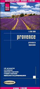
Provence, French Riviera and the southern part French Alps at 1:250,000 on a light, waterproof and tear-resistant map published by Reise Know-How as part of their highly acclaimed Wold Mapping Project. The map is double-sided, with a small overlap between the sides, and extends from the western side of the Rhรดne to the Italian border – coverage south of Avignon goes further west along the A9 motorway to Nรฎmes, Montpellier and Sรจte; in the north the map extends beyond the Ecrins and the Vercors massifs to Grenoble.Topography is presented by altitude colouring with names of mountain ranges, peaks, passes, etc; the region’s numerous national or regional parks are prominently highlighted. Road network indicates tolls and services (but not Aires de repos), and shows driving distances on main and secondary routes. Symbols indicate various places of interest including campsites, viewpoints, historical and archaeological sites, etc. The map is indexed and has latitude and longitude lines at intervals at 10’ plus UTM margin ticks. Map legend includes English.

Related Products:
 Scotland Reise Know-How
 USA Reise Know-How
 Poland Southeast Reise Know-How
 Cape Region – South Africa Reise Know-How
 Provence-Alps – French Riviera Michelin Regional 527
 Poland Southwest Reise Know-How
 Southern England – Wales Reise Know-How
 Germany South K+F Road Map
 USA: Reise Know-How Regional Touring Maps
 Chile Compass Road Map
Brittany – Brest – Rennes K+F Regional Road Map
Chile Compass Road Map
Brittany – Brest – Rennes K+F Regional Road Map
 Portugal Reise Know-How
 India Northwest Reise Know-How
 Slovakia
 Poland Reise Know-How
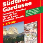 South Tyrol – Lake Garda
 Canada West Reise Know-How
 Indonesia: Reise-Know How Regional Maps
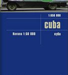 Cuba Reise Know-How
 Sri Lanka Reise Know-How
 California Reise Know-How
 Benelux F&B
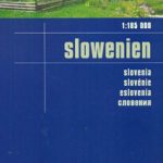 Slovenia Reise Know-How
 Ireland Marco Polo Map
 Pyrenees Reise Know-How
 Ghana – Togo Reise Know-How
 Alsace – Vosges K+F Road Map
 Florida Reise Know-How
 Yucatan Reise Know-How
 Slovakia Reise Know-How
 Belarus Reise Know-How
 Guyana – Suriname – French Guiana Reise Know-How
 Guatemala – Belize Reise Know-How
 Ireland Reise Know-How
 Surrey, East & West Sussex A-Z Visitors` Map
 South Africa Reise Know-How
 Germany K+F Road Map
 Jordan Reise Know-How
 Spain: Mairdumont 300K Regional Road Maps