Disclosure : This site contains affiliate links to products. We may receive a commission for purchases made through these links.
Istanbul Marco Polo City Map
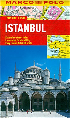
Istanbul on a waterproof and tear-resistant street plan at 1:15,000 from Marco Polo Travel Publishing with a detailed map of the Grand Bazaar, a diagram of the metro and tram network, an index with lists of places of interest, etc.On the main map coverage west of the Golden Horn extends along the coast to Yedikule and in the north-west to the Haliรง Bridge; in the modern part of the city, the plan extends along the Bosphorus to the Besiktas football stadium. On the reverse two separate panels at the same scale extend the plan beyond Besiktas to include the Dolmabahรงe Palace and coastal part of the Asian side of the city. The tramline linking Istanbul’s historic centre with the districts east of the Golden Horn is shown with stops, metro stations are clearly marked, also the historic tram route along the Istiklร
: l. The plan also shows ferry piers and the numerous ferry connections. Important buildings are highlighted and named. Street index on the reverse side includes separate lists and where appropriate contact details of various places of interest and facilities, such as public transport offices, accommodation agencies, museums, etc.An enlargement shows the Grand Bazaar with names of the various streets within it. Also provided is a diagram of the metro and tram network, plus a road map of the city’s outer suburbs showing access to the international airport and the two bridges across the Bosphorus.Cartography in this title is from the renowned German map publishers MairDumont and the multilingual map legend includes English.


