Disclosure : This site contains affiliate links to products. We may receive a commission for purchases made through these links.
Florida F&B
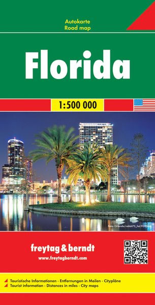
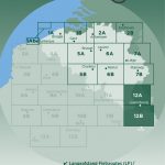
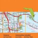
Florida at 1: 500,000 on a double-sided, indexed road map from Freytag and Berndt with place names in larger print than found on most other maps of the state and icons prominently highlighting various places of interest, plus panels with street plans of central Orlando, Miami Beach and Jacksonville. The map divides the state north – south, with the southern half starting well north of Palm Coast and Daytona Beach, so covering all the Florida’s most visited locations and attractions, but PLEASE NOTE: the way the publishers have marked Disney World makes it very difficult to find it on this map! The map shows the state’s road network with driving distances (in miles) on main routes. County boundaries and names are prominently marked. National/state parks, forests and other protected areas are highlighted. Large icons indicate numerous places of interest, including campsites. Latitude and longitude lines are drawn at 20’ intervals. Multilingual map legend includes English.Also provided are large panels with street plans of central Orlando, Miami Beach and Jacksonville.

Related Products:
 Florida Hildebrand`s Road Map
 Florida Easy-to-Read Rand McNally
 Florida NGS Guide Map
 Miami & South Florida ITMB
 Southeast USA – The South & Florida Borch
 Orlando & Central Florida ITMB
 USA South: Atlantic States ITMB
 Florida USA 11 Hallwag Road Map
 Florida Central & Eastern Regional Rand McNally
 Moon Florida
 Miami FL Rand McNally
 Deep South – Mississippi to Florida Michelin Zoom 177
 The Rough Guide to Florida
 Fodor`s Florida
 Jacksonville FL Rand McNally
 Miami Borch
 Florida Marco Polo Guide
 Reg 8.3 Florida Southeast, Lake Worth to Plantation Key
 DK Eyewitness Travel Guide Florida
 Florida & US Deep South ITMB
 DK Eyewitness Family Guide Florida
 Florida Keys Adventure & Dive Map-Guide
 USA North-East
 Lonely Planet Best of Florida
 Moon South Florida & the Keys Road Trip (First Edition): With Miami, Walt Disney World, Tampa & the Everglades
 Florida Reise Know-How
 Fodor`s South Florida: With Miami, Fort Lauderdale, and the Keys
 South Africa F&B
 Java – Jakarta F&B
 NOAA Charts for Jacksonville, Florida to Cape Hatteras
 50 Hikes in Central Florida
 Florida ITMB
Sri Lanka & India South ITMB
Florida Keys ITMB
Florida ITMB
Sri Lanka & India South ITMB
Florida Keys ITMB
 Miami – Fort Lauderdale – West Palm Beach FL Regional Rand McNally
 Bangladesh & India East ITMB
 Florida Insight Travel Map
 Florida State Physical Wall Map
Taiwan Nelles
Florida State Physical Wall Map
Taiwan Nelles