Disclosure : This site contains affiliate links to products. We may receive a commission for purchases made through these links.
Europe Physical F&B
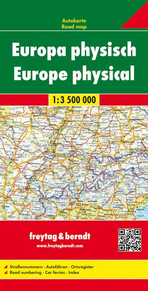
Europe at 1:3,500,000 on an indexed map from Freytag & Berndt providing an overview of the road network on a base with relief shading to indicate the topography. Coverage extends beyond Moscow and to the eastern coastline of the Black Sea, with northern Scandinavia and Finland shown on an inset at a less detailed scale.Relief shading with names of mountain rages shows the topography. Country borders are clearly marked. Country names are indicated by the codes used on car number plates (FR, D, CZ, PL, etc.); names of cities are as used in their countries, so Mรผnchen, Warszawa, Firenze, Athina, etc. In Greece and countries using Cyrillic alphabet place names are in the Latin alphabet only. The map shows the network of motorway routes with connecting regional and selected other roads. Driving distances are shown on main roads. The map also shows principal rail connections and airports. Latitude and longitude lines are drawn at 2ยบ30’ intervals. The index is on the reverse. Map legend includes English.

Related Products:
 Europe K+F Physical Map
 Europe K+F Physical Wall Map LAMINATED
 Europe – Middle East – Central Asia F&B
 Balkans NGS Classic Wall Map PAPER
 Europe – Middle East – Central Asia Freytag & Berndt Wall Map
 Europe F&B Compact Road Atlas
 Balkans – South-East Europe F&B
 Europe Eastern F&B
 Greece NGS Classic Wall Map PAPER
 Europe K+F Long-Distance Routes Map
 Georgia
 Ukraine South
 Europe Marco Polo Maxi Atlas 2017/2018 A3
 Mongolia Gizi Road Map
 Balkans NGS Classic Wall Map ENCAPSULATED
 Greece F&B
 Macedonia Gizi Map
 Mongolia Road Edition Wall Map
 Bulgaria (with Fishing Lakes)
 Andalusia Autonomous Community CNIG Physical Road Map
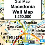 Macedonia Wall Map
 Catalonia Auotomous Community CNIG Physical Road Map
 Europe Travellers` Railway Map
Spain CNIG Physical Wall Map
Europe Travellers` Railway Map
Spain CNIG Physical Wall Map
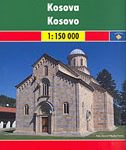 Kosovo F&B Top 10 Tips
 Mediterranean Countries NGS Classic Wall Map PAPER
 Aragรณn Autonomous Region 300K CNIG Physical Road Map
 Middle East: Maps International Political Wall Map
 Canary Islands Autonomous Region 350K CNIG Physical Road Map
 Bulgaria Domino DOUBLE-SIDED Road Map
 Serbia North F&B
 Thrace and Eastern Macedonia Terrain Editions Regional Map 1
 Bulgaria (with Street Plans of Black Sea Resorts)
 Cantabria Autonomous Community CNIG Physical Road Map
Extremadura Auotomous Community CNIG Physical Road Map
Cantabria Autonomous Community CNIG Physical Road Map
Extremadura Auotomous Community CNIG Physical Road Map
 USA Michelin Physical Wall Map ENCAPSULATED
 Central Macedonia Terrain Editions Regional Map 2
 Europe AA Route Planner
 Europe K+F Political Wall Map LAMINATED