Disclosure : This site contains affiliate links to products. We may receive a commission for purchases made through these links.
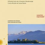
Seeland / Trois Lacs
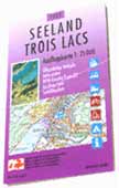
Second edition of a special map originally produced by the Swiss national survey organisation for the Expo01. The map is a photographic enlargement of the Swiss topographic survey at 1:100,000 and covers the area around the four main venues: Neuchร
: tel, Biel/Bienne, Yverdon-les-Bains and Murten, extending east to include Fribourg and Berne. The map carries extensive tourist information: railways, bus routes and ferry lines are cross-referenced to the national timetable; bus routes are highlighted and show bus stops; national and regional cycle routes are indicated, as well as cycle hire facilities; etc.On the reverse, there is an index, a general road map of Switzerland, a distance table, and a panorama of the Alps as seen from Mont Vully near Murten.

Related Products:
 Neuchรขtel – Trois Lacs – Seeland – Fribourg K+F Cycling Map 8
 Murten Swisstopo 1165
 Denmark F&B Top 10 Tips 2-Map Set
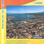
 Geneva CityPocket Street Plan
 Murten – Neuchรขtel – Freiburg K+F Hiking Map 17
 Gorges, Lacs et Plateaux du Verdon ร pied FFRP Topo-guide No. P042
 Domodossola – Val Grande National Park Swisstopo Hiking 285T
 Delรฉmont Swisstopo Hiking 223T
 Sardona Swisstopo Hiking 247T
 Brienne-le-Chateau – Piney – Lacs de la Foret d`Orient IGN 2917SB
 Les Trois Vallees – Modane – PN de la Vanoise IGN 3534OT
 Col du Marchairuz Swisstopo Hiking 460T
 Baden Swisstopo Hiking 215T
 Arbon Swisstopo Hiking 217T
 Tarasp Swisstopo Hiking 249T
 Bulle Swisstopo Hiking 252T
 Gantrisch Swisstopo Hiking 253T
 Sustenpass Swisstopo Hiking 255T
 Nufenenpass Swisstopo Hiking 265T
 Zurich Swisstopo Hiking 225T
Liestal Swisstopo Hiking 214T
Zurich Swisstopo Hiking 225T
Liestal Swisstopo Hiking 214T
 Frauenfeld Swisstopo Hiking 216T
 Olten Swisstopo Hiking 224T
 Rapperswil Swisstopo Hiking 226T
Willisau Swisstopo Hiking 234T
Rapperswil Swisstopo Hiking 226T
Willisau Swisstopo Hiking 234T
 Lachen Swisstopo Hiking 236T
 Val de Travers Swisstopo Hiking 241T
 Avenches Swisstopo Hiking 242T
 Bern Swisstopo Hiking 243T
Escholzmatt Swisstopo Hiking 244T
Bern Swisstopo Hiking 243T
Escholzmatt Swisstopo Hiking 244T
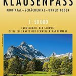 Klausenpass Swisstopo Hiking 246T
 La Sarraz Swisstopo Hiking 251T
Safiental Swisstopo Hiking 257T
San Bernardino Swisstopo Hiking 267T
Malcantone Swisstopo Hiking 286T
La Sarraz Swisstopo Hiking 251T
Safiental Swisstopo Hiking 257T
San Bernardino Swisstopo Hiking 267T
Malcantone Swisstopo Hiking 286T
 Great Britain: Ordnance Survey Tour Maps
Disentis / Mustรฉr Swisstopo Hiking 256T
Valreas – Saint-Paul-Trois-Chateaux IGN 3039ET
Great Britain: Ordnance Survey Tour Maps
Disentis / Mustรฉr Swisstopo Hiking 256T
Valreas – Saint-Paul-Trois-Chateaux IGN 3039ET
 Geneva: Greater Geneva Street Plan
Basel – Sundgau – Blaueberg – Gempen Swisstopo Hiking 213T
Geneva: Greater Geneva Street Plan
Basel – Sundgau – Blaueberg – Gempen Swisstopo Hiking 213T