Disclosure : This site contains affiliate links to products. We may receive a commission for purchases made through these links.
North America: Kรผmmerly + Frey Political Wall Map
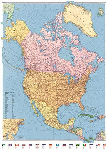
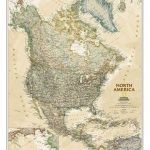
North America Political Wall Map at 1:8,000,000 from Kรผmmerly + Frey, size 90 x 125cm (35.5″ x 49″ approx), presenting countries in pleasant pastel colours against oceans in darker rich blue. The map covers the whole continent from the northernmost islands of Canada to Panama, also Greenland and Iceland, with the Aleutian Islands shown as an inset. The Caribbean is covered only as far as the eastern tip of the Dominican Republic (so with the Bahamas, Cuba, Haiti, Dominican Republic, Cayman Islands and Jamaica, but without the Lesser Antilles). An inset shows the eastern seaboard of USA from New York to Washington DC in greater detail.All place names are in their English versions. Topography is shown by subtle relief shading, with plenty of names of various topographic features: mountain ranges, peaks, etc. Altitude both in USA and elsewhere is given in feet. Within Canada, USA and Mexico province/state boundaries and names are included. The map shows the network of main road and rail connections, plus selected domestic airports, national parks and archaeological remains. Latitude and longitude lines are drawn at 5ยฐ. Multilingual map legend includes English.Along the bottom of the map is a colourful border of country flags.* This title is also available folded.

Related Products:
 North America Columbus double-sided Political / Physical Wall Map
 North America: Maps International Political Wall Map PAPER
 World: Kรผmmerly + Frey Political Wall Maps
 Stanford`s Folio North America Map (1884) – A3 Wall Map, Paper
Stanford`s Folio North America Map (1884) – A2 Wall Map, Paper
Stanford`s Folio North America Map (1884) – A1 Wall Map, Paper
Stanford`s Folio North America Map (1884) – A4 Wall Map, Canvas
Stanford`s Folio North America Map (1884) – A3 Wall Map, Canvas
Stanford`s Folio North America Map (1884) – A2 Wall Map, Canvas
North America Maps International Political Wall Map HANGING STRIPS
North America: Maps International Political Wall Maps
Stanford`s Folio North America Map (1884) – A3 Wall Map, Paper
Stanford`s Folio North America Map (1884) – A2 Wall Map, Paper
Stanford`s Folio North America Map (1884) – A1 Wall Map, Paper
Stanford`s Folio North America Map (1884) – A4 Wall Map, Canvas
Stanford`s Folio North America Map (1884) – A3 Wall Map, Canvas
Stanford`s Folio North America Map (1884) – A2 Wall Map, Canvas
North America Maps International Political Wall Map HANGING STRIPS
North America: Maps International Political Wall Maps
 North America NGS Executive Wall Map PAPER
 North America NGS Classic Wall Map PAPER
 North America NGS Classic Wall Map LARGE PAPER
North America: NGS Classic Style Wall Maps
North America NGS Classic Wall Map LARGE PAPER
North America: NGS Classic Style Wall Maps
 South America Maps International Political Wall Map PAPER
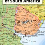 South America: Maps International Political Wall Map HANGING STRIPS
 North America NGS Executive Wall Map ENCAPSULATED
North America NGS Classic Wall Map ENCAPSULATED
North America NGS Executive Wall Map ENCAPSULATED
North America NGS Classic Wall Map ENCAPSULATED
 South America Global Mapping Political Wall Map PAPER
 North America NGS Classic Wall Map LARGE ENCAPSULATED
 North America: Tapestry of Time and Terrain Wall Map
South America Maps International Political Wall Map ENCAPSULATED
South America: Maps International Political Wall Maps
North America: Tapestry of Time and Terrain Wall Map
South America Maps International Political Wall Map ENCAPSULATED
South America: Maps International Political Wall Maps
 North America Raven Maps Wall Map LAMINATED
 Spessart North – Bad Orb – Steinau – Burgsinn 35K Kรผmmerly + Frey Map No. 49
 World Maps International Executive Political Wall Map
 USA: The Essential Geography of the United States of America Wall Map PAPER
 North American Indian Cultures NGS Wall Map
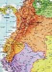
 Central America – Caribbean Islands – Mexico
 USA Michelin Political Wall Map PAPER
 World F&B Political Wall Map LARGE
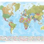 World Marco Polo Political Wall Map
 World F&B Political Wall Map MEDIUM
 China Gizi Map Geographical Wall Map
 World F&B Political Wall Map MEDIUM – with Metal Hanging Strips
 World K+F Political 30M Wall Map LAMINATED
 Iran Wall Map
 USA: The Essential Geography of the United States of America Wall Map ENCAPSULATED
 Germany: Kรผmmerly+Frey 275K Regional Road Map