Disclosure : This site contains affiliate links to products. We may receive a commission for purchases made through these links.
Finistรจre Sud – Quimper ‘“ Douarnenez ‘“ Pont-l’Abbรฉ Rando Editions
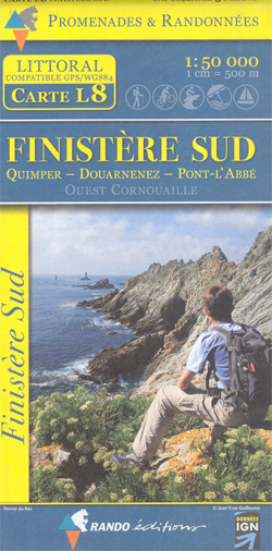
Finistรจre Sud, the south-western corner of Brittany with Quimper, Douarnenez and Pont-l’Abbรฉ, in a series of GPS compatible hiking and cycling maps at 1:50,000 from Rando Editions, publishers of similar series for the French Alps and the Pyrenees.The map has cartography from the IGN with contour lines at 10m intervals, enhanced by relief shading, plus graphics and/or colouring for rocky coastline, mud flats, woodlands, etc. An overprint highlights GR routes and other hiking trails, indicating waymarked paths and difficult sections. Also clearly marked are recommended cycling routes, including off-road mountain bike trails. Symbols indicate various places of interest, including campsites and gรฎtes d’etape, beaches, numerous centres for various recreational sports (paragliding, hand-gliding, canoeing, horse riding, surfing, etc.), yachting harbours and marinas, the area’s historical and cultural heritage, tourist information centres, etc. Road and rail networks are presented with detail expected of topographic maps at this scale. The map has a 2km UTM grid. Map legend includes English.

Related Products:
 Ile d`Olรฉron – Ile de Rรฉ Rando Editions
 France: Rando Editions/IGN 50K Walking Maps of the Pyrenees
 Pays Basque East Rando Editions 2
 Bรฉarn – Aspe – Ossau – Pyrenees National Park Rando Editions 3
 Pays Basque West Rando Editions 1
 Luchon Rando Editions 5
 Beaufortain Rando Editions
Vanoise Rando Editions
Ecrins Rando Editions
Beaufortain Rando Editions
Vanoise Rando Editions
Ecrins Rando Editions
 Gavarnie-Ordesa Rando Editions 12
 Mont Blanc Rando Editions
 Canigou-Garrotxa Rando Editions 10
 Belledonne Rando Editions
 Collioure-Cadaquรฉs Rando Editions 11
 Le Sentier Cathare – Queribus – Peyrepertuse Rando Editions 9
 Couserans-Val d`Aran Rando Editions 6
 Haute-Ariรฉge Rando Editions 7
 Bigorre – Cauterets – Gavarnie – Saint-Lary-Soulan – Pyrenees NP Rando Editions 4
 Cerdagne-Capcir Rando Editions 8
France: Rando Editions 50K Walking Maps of the French Alps
Cerdagne-Capcir Rando Editions 8
France: Rando Editions 50K Walking Maps of the French Alps
 El Pont de Suert
 Basque Country IGN 75023
 Cรฉvennes – Gorges du Tarn IGN 75011
 Perigord Noir – Haut-Quercy IGN 75026
 Cรฉzallier – Monts du Cantal IGN 75016
 Foret d`Orient – Lac du Der-Chantecoq IGN 75039
 Chartreuse – Belledonne IGN 75002
Gavarnie – Neouvielle – Luchonnais – Pic du Midi de Bigorre IGN 75019
Chartreuse – Belledonne IGN 75002
Gavarnie – Neouvielle – Luchonnais – Pic du Midi de Bigorre IGN 75019
 Haut-Languedoc IGN 75022
 Golfe du Morbihan – Belle-รle et Groix – Presqu`รle de Quiberon IGN 75017
 Chaรฎne des Puys – Massif du Sancy IGN 75015
 Pointe du Raz – Presqu`รฎle de Crozon – Ouessant – les Abers IGN 75024
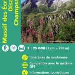 Massif des Ecrins – Oisans – Champsaur IGN 75006
France: IGN 75K/25K TOP75 Recreational Maps
Massif des Ecrins – Oisans – Champsaur IGN 75006
France: IGN 75K/25K TOP75 Recreational Maps
 Lake Balaton II West Cartographia Water Sports & Cycling Map
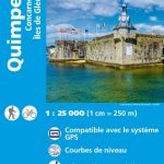 Quimper – Concarneau – Iles de Glenan IGN 0519ET
 Chateaulin – Douarnenez IGN 0518OT
Morvan IGN 75025
Chateaulin – Douarnenez IGN 0518OT
Morvan IGN 75025
 Mt Parnitha Terrain Editions 239
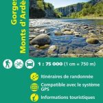 Gorges and Monts d`Ardรจche IGN 75014