Disclosure : This site contains affiliate links to products. We may receive a commission for purchases made through these links.
Reunion IGN 84974
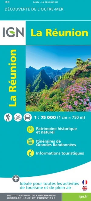
Reunion on a detailed, contoured and GPS compatible map at 1:75,000 from the IGN with a vivid presentation of the island’s topography, hiking routes, places of interest and tourist facilities, plus a street plan of Saint-Denis.The island’s topography is presented by contours at 200m intervals, vividly enhanced by bold relief shading, plus plenty of names of geographical features and colouring or graphics to show forests, brushwood, marshland and areas liable to flooding. Boundaries of protected areas are marked.Road network indicates unsurfaced roads and includes cart tracks and local paths. Driving distances are marked on main and many secondary routes and scenic roads are prominently highlighted. The map also shows both local hiking paths and the island’s two GR long-distance walking trails. A range of symbols indicate tourist accommodation (holiday villages, campsites and mountain shelters), numerous sport and recreational facilities including beaches and diving sites, local markets and handicraft, etc. The map has a UTM grid, plus latitude and longitude lines. Map legend includes English.

Related Products:
 Galway County
 Psara Terrain Editions 329
 Thasos Terrain Editions 323
Kerry County
Thasos Terrain Editions 323
Kerry County
 Cork County
 Clare County
 Sรฃo Nicolau AB Kartenverlag Hiking Map
 Kea / Tzia Terrain Editions 301
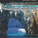 Skiathos Terrain Editions 319
 Martinique IGN 84972
 Skopelos Terrain Editions 320
 Chios Terrain Editions 328
 Kos Terrain Editions Map 338
 Kalymnos Terrain Editions 337
 Milos – Kimolos – Polyeghos Terrain Editions 306
 Santorini Terrain Editions 313
 Ios Terrain Editions 315
 Sikinos Terrain Editions 317
 Ikaria Terrain Editions 332
 Samothrace Terrain Editions 324 SUPERCEDED
 Samos Terrain Editions 331 SUPERCEDED
 Donousa 15K Terrain Editions Pocket Map
 Aghios Efstratios Terrain Editions 326
 Kythira Terrain Editions 346
 Tinos Terrain Editions 308
 Samos Terrain Editions 331
 Symi Terrain Editions 341
 Fourni Terrain Editions 333
 Slovenia F&B
 Heraklia 15K Terrain Editions Pocket Map
 Astypalaea / Astypalaia Terrain Editions 330
 Leros Terrain Editions 336
 Syros Terrain Editions 305
 Sifnos Terrain Editions 304
 Anafi Anavasi 10.47
 Nisyros Terrain Editions 339
 Alonissos Terrain Editions 321
 Anafi Terrain Editions 318
Folegandros Terrain Editions 316
Anafi Terrain Editions 318
Folegandros Terrain Editions 316
 Kythnos Terrain Editions 302