Disclosure : This site contains affiliate links to products. We may receive a commission for purchases made through these links.
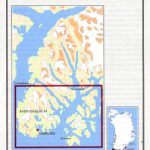
Brittany Wall Map
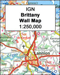
Wall map of the French administrative region of Brittany at 1:250,000 from the IGN, size 130 x 100cm (51″ x 39.5″ approx) and encapsulated for durability and for adding customized information by marker pens. An inset presents the division of the region into departments and communes, each shown with its administrative capital.Cartography is the same as in IGN’s folded map of Brittany in their popular Regional Road Maps series of France, with very clear presentation of the road network, including junctions numbers, services and rest area on motorways, driving distances shown from main to selected small local roads, etc. Railway lines are shown with stations, ferry lines are included and local airports/aerodromes are marked. Various places of interest are prominently highlighted. The map also clearly shows departmental numbers and boundaries. Topography is indicated by light relief shading and boundaries of national/natural parks are marked. Unlike the corresponding folded map, this wall map version has no geographical coordinates, no index and no map legend, but all the information is self-explanatory. Current edition of this title was published in spring 2014.LAMINATED and ENCAPSULATED WALL MAPS:- LAMINATED wall maps have a thin layer of plastic usually applied to the printed side only. They can be written on with suitable marker pens without any damage to the map but, unless laminated on both sides, they are not damp-proof.- ENCAPSULATED wall maps are sealed between two sheets of plastic. They are more rigid and heavier than laminated maps of the same size. They are damp-proof and do not crinkle in humid conditions. Encapsulation gives the map a shiny surface, similar to being displayed behind glass.- PLEASE NOTE: many publishers and retailers often use these two terms interchangeably. Our map titles and descriptions follow the definitions provided above.

Related Products:
 France IGN Administrative Wall Map
 Brazil NGS Executive Wall Map ENCAPSULATED
 Mexico NGS Classic Wall Map ENCAPSULATED
 England and Wales NGS Classic Wall Map ENCAPSULATED
 Ireland NGS Classic Wall Map ENCAPSULATED
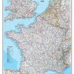
 France, Belgium and Netherlands NGS Executive Wall Map ENCAPSULATED
 North America NGS Executive Wall Map ENCAPSULATED
 Mexico NGS Executive Wall Map ENCAPSULATED
 Spain and Portugal NGS Classic Wall Map ENCAPSULATED
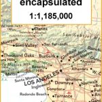 California NGS Wall Map ENCAPSULATED
 China NGS Classic Wall Map ENCAPSULATED
 Ireland NGS Executive Wall Map ENCAPSULATED
 Canada NGS Classic Wall Map ENCAPSULATED
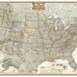
 USA Michelin Political Wall Map ENCAPSULATED
 Costa Rica NGS Wall Map ENCAPSULATED
 Spain and Portugal NGS Executive Wall Map ENCAPSULATED
 Britain and Ireland NGS Classic Wall Map ENCAPSULATED
 South Africa NGS Classic Wall Map ENCAPSULATED
North America NGS Classic Wall Map ENCAPSULATED
South Africa NGS Classic Wall Map ENCAPSULATED
North America NGS Classic Wall Map ENCAPSULATED
 Australia NGS Classic Wall Map ENCAPSULATED
 North America NGS Classic Wall Map LARGE ENCAPSULATED
 Australia NGS Executive Wall Map ENCAPSULATED
 France, Belgium and Netherlands NGS Classic Wall Map LAMINATED
 Scotland NGS Classic Wall Map ENCAPSULATED
 Iraq NGS Classic Wall Map ENCAPSULATED
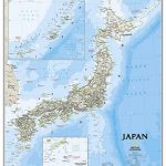 Japan NGS Classic Wall Map ENCAPSULATED
 England and Wales NGS Executive Wall Map ENCAPSULATED
Greece NGS Classic Wall Map ENCAPSULATED
England and Wales NGS Executive Wall Map ENCAPSULATED
Greece NGS Classic Wall Map ENCAPSULATED
 USA: NGS Executive Style Wall Maps
 United States NGS Executive Wall Map ENCAPSULATED
Scotland NGS Executive Wall Map ENCAPSULATED
United States NGS Executive Wall Map ENCAPSULATED
Scotland NGS Executive Wall Map ENCAPSULATED
 United States NGS Executive Wall Map LARGE PAPER
 China NGS Executive Wall Map ENCAPSULATED
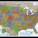 United States NGS Decorator Wall Map ENCAPSULATED
 Japan NGS Executive Wall Map ENCAPSULATED
USA: NGS Decorator Style Wall Maps
Japan NGS Executive Wall Map ENCAPSULATED
USA: NGS Decorator Style Wall Maps
 Caribbean NGS Classic Wall Map ENCAPSULATED
 Balkans NGS Classic Wall Map ENCAPSULATED
United States NGS Classic Wall Map ENCAPSULATED
Balkans NGS Classic Wall Map ENCAPSULATED
United States NGS Classic Wall Map ENCAPSULATED
 South America NGS Executive Wall Map ENCAPSULATED