Disclosure : This site contains affiliate links to products. We may receive a commission for purchases made through these links.
Pyrenees Rando Editions
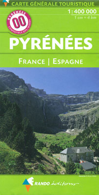
Pyrenees coast to coast and across both sides of the border presented by Rando Editions on a map at 1:400,000 with coverage extending from Auch, Toulouse and Bรฉziers in France to Bilbao, Logroรฑo, Zaragoza, Lleida and Barcelona in Spain; plus prominent highlighting of the region’s national / natural parks.Relief shading and altitude colouring presents the region’s topography, with names of valleys, peaks, passes, etc. National parks and other protected areas are prominently marked. Road network includes selected local roads, although fewer than on similar coverage from other publishers. Symbols highlight locations worth visiting and other places of interest or areas for recreational pursuits. The map has no geographical coordinates for GPS (contrary to the icon on its cover!). Map legend includes English. Accompanying text about various aspects of the region, illustrated with photos and maps, is in French only.


