Disclosure : This site contains affiliate links to products. We may receive a commission for purchases made through these links.
Nantes and Surrounding Area Michelin Zoom 128
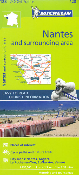
Nantes and the surrounding area presented by Michelin at 1:150,000, with city maps of central Nantes, Angers, La Roche-sur-Yonne, St. Nazaire and Vannes. Coverage extends upstream along the Loire to Angers, and along the coast north to Vannes and the Golfe de Morbihan and south to Les Sables-d’Olonne, including Ile de Noirmoutiers and Ile d’Yeu. Locations worth visiting are prominently highlighted and have star rating. The map has latitude and longitude lines at 10’ intervals and is indexed. Accompanying city maps have indexes of main streets.Michelin Zoom series of France covers popular holiday areas with Michelin’s road mapping either adapted to provide more convenient coverage or enlarged for greater clarity. Presentation of the road network includes scenic routes and viewpoints, classification according to the number of lanes, motorway junctions indicating full or partial interchanges, motorway services and rest areas, gradients, limited height and load, entry restrictions, etc. Railway lines are included. Small symbols mark various places of interest and in the more recently published titles towns, villages and areas of particular interest are allocated star rating. Unless specified to the contrary in the individual description, the maps are indexed. All the titles have an English language map legend.To see the list of titles in this series please click on the series link.


