Disclosure : This site contains affiliate links to products. We may receive a commission for purchases made through these links.
Melbourne to Sydney Hema
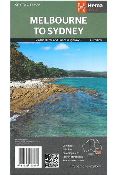
The south-eastern corner of Australia between Melbourne and Sydney on an indexed road map at 1:900,000 from Hema, with enlargements showing suburban roads in these two cities, distance tables for the Hume and Princes Highways, plus on the reverse extensive tourist information including a table of facilities in the national parks.Coverage inland extends to the Lachan Valley in NSW in the north-western corner of the map and in the Sydney region includes the Great Western Highway across the Blue Mountain National Park, with Bathurst on the northern edge of the map. Road network indicates sealed or unsealed roads and 4WD tracks, with driving distances marked on main routes. The two main routes between the two cities, the Hume and the Prices Highway are highlighted, with a distance table for each placed one next to the map. Icons indicate various facilities including camping areas and caravan parks, different types of rest areas, a selection of 24hr fuel stations, visitor centres, etc. Topography is very effectively presented by relief shading plus spot heights and names of mountain ranges, etc, plus colouring indicating national or state parks and other protected areas where the map also shows numerous hiking trails. Latitude and longitude lines are drawn at 1ยบ intervals. The map is indexed and includes two additional panels presenting in greater detail through roads across the suburbs or Melbourne and Sydney.On the reverse is a table showing what facilities can be found in over 90 national parks, contact details for Visitor Information Centres, plus extensive notes about the region’s best sights, many illustrated with colour photos.To see the list of titles in this series please click on the series link.


