Disclosure : This site contains affiliate links to products. We may receive a commission for purchases made through these links.
Oxford: Faden`s Map 1789
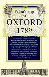
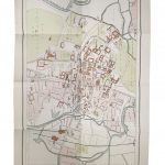
A street plan of Oxford in 1789 published by William Faden and reproduced by the Old House Books. Although based on a survey made 40 years earlier, the plan represented a great step forward from the earlier decorative bird’s-eye view maps of the city, providing much more accuracy and detail. Coverage extends from St Thomas’s Church to the Magdalen College Meadow and from St Giles Church to just beyond the Folly Bridge. 25 colleges and halls are numbered and listed in a separate panel. Another panel provides a list of ‘The Number of Houses and Inhabitants in each Street” with 22 entries, e.g. Broad Street and New Collage Lane: 105 houses, 516 inhabitants.The plan, prepared by William Faden, Geographer to the King and a cartographer with a prolific output of over 350 maps and plans who was also instrumental in preparing the first Ordnance Survey maps, has also panels with drawings of the west faรงade and the Peckwater Quadrangle of Christ Church, the New Building of Madgalen and the Observatory, plus brief but interesting notes about the town (8292 inhabitants, exclusive of the University, etc). The map is presented in an elegant card cover with an essay about Oxford in the 18th century.Please note: this title is also available as a wall map.To see other titles in this series please click on the series link.


