Disclosure : This site contains affiliate links to products. We may receive a commission for purchases made through these links.
South East Queensland – 4WD + Camping Escapes Atlas & Guide A4 SPIRAL-BOUND
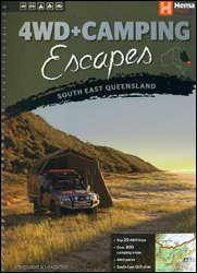
South East Queensland 4WD + Camping Escapes guide and atlas from Hema in an A4 spiral-bound format, covering Brisbane and its hinterland, the Gold Coast, Fraser Island, etc. Descriptions of interesting sights and best 4WD tracks, a camping directory, etc, are combined with a road atlas of the whole region.Coverage extends from the border with New South Wales northwards to Bundaberg and Burnett Heads, and inland beyond Dalby. Five regional chapters provide descriptions of touring highlights and information on recommended 4WD tracks and camping areas, all accompanied by map extracts, plus a camping directory listing facilities and contact details.The atlas section covers the region 1:500,000, Road network distinguishes between sealed and unsealed roads and includes rough tracks. Driving distances are marked on main and on most local roads and tracks. Symbols show information centres, campsites, rest areas with/without overnight accommodation, 24hours fuel, etc. The maps also indicate location of campsites and 4WD tracks listed in the guide section. Topography is presented by relief shading with colouring and/or graphics for national parks and other protected areas. All pages have a latitude and longitude grid at intervals of 30’. The index refers both to the atlas pages and to the guide section. Also provided is a street plan of central Brisbane annotated with recommendations for places of interest and accommodation, plus a map showing the city’s suburbs.To see the full range of Hema’s road atlases and guides to Australia and its states please click on the series link.

Related Products:
 Perth & the South West – 4WD + Camping Escapes Atlas & Guide A4 SPIRAL-BOUND
 Cape York Hema Atlas & Guide A4 SPIRAL-BOUND
 The Kimberley Hema Atlas & Guide SPIRAL-BOUND
 Australia Great Desert Tracks Hema Atlas & Guide A4 SPIRAL-BOUND
 Victoria – The High Country Atlas & Guide A4 SPIRAL-BOUND
 South East Queensland Hema
 Western Australia Hema Road & 4WD Track Atlas A4 SPIRAL-BOUND
 South East Queensland – featuring Landcruiser Mountain Park Hema Explorer Map
 Australia Hema Motorcycle Atlas Set – 200 Top Rides SPIRAL-BOUND
 France Michelin Camping Car Atlas A4 SPIRAL-BOUND
 New Zealand Hema Touring Atlas A4 SPIRAL-BOUND
 Australia Hema Truckies Atlas SPIRAL-BOUND B4
 Australia Hema Road & 4WD Atlas SPIRAL-BOUND
 Australia Hema Road & 4WD Touring Atlas A4 SPIRAL-BOUND
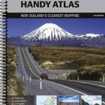 New Zealand Hema Handy Atlas SPIRAL-BOUND
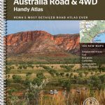 Australia Hema Handy Atlas SPIRAL-BOUND
 Australia Hema Road & 4WD Easy Read Atlas SPIRAL-BOUND
 USA Hema The Ultimate Road Atlas A3 SPIRAL-BOUND
USA Rand McNally Road Atlas & National Park Guide 2022 A3 SPIRAL-BOUND
North East New South Wales – Coffs Harbour to Brisbane Hema Explorer Map
USA Hema The Ultimate Road Atlas A3 SPIRAL-BOUND
USA Rand McNally Road Atlas & National Park Guide 2022 A3 SPIRAL-BOUND
North East New South Wales – Coffs Harbour to Brisbane Hema Explorer Map
 USA – Canada – Mexico Michelin Road Atlas 2021 SPIRAL-BOUND
France Michelin Road Atlas 2022 SPIRAL-BOUND TEAR-RESISTANT
USA – Canada – Mexico Michelin Road Atlas 2021 SPIRAL-BOUND
France Michelin Road Atlas 2022 SPIRAL-BOUND TEAR-RESISTANT
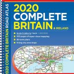 Britain & Ireland Philip`s Complete Road Atlas 2020 SPIRAL-BOUND
 France Philip`s Navigator Road Atlas SPIRAL-BOUND
 USA NGS Adventure Edition Road Atlas A3 SPIRAL-BOUND
 Hungary – Budapest Road Atlas SPIRAL-BOUND
 Britain & Ireland Philip`s Road Atlas 2022 A4 SPIRAL-BOUND
 New Zealand Kiwimaps Compact Travellers Atlas SPIRAL-BOUND
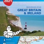 Great Britain & Ireland Michelin Main Roads Atlas 2021 SPIRAL-BOUND
 Britain Philip`s Navigator Trucker`s Road Atlas A3 SPIRAL-BOUND
 Norway Cappelens Road Atlas A4 SPIRAL-BOUND
 Australia UBD Gregory`s Road Atlas A4 SPIRAL-BOUND
Flinders Ranges Hema Atlas & Guide PAPERBACK
USA Rand McNally Large Scale Road Atlas 2022 A3 SPIRAL-BOUND
Australia UBD Gregory`s Road Atlas A4 SPIRAL-BOUND
Flinders Ranges Hema Atlas & Guide PAPERBACK
USA Rand McNally Large Scale Road Atlas 2022 A3 SPIRAL-BOUND
 Britain Philip`s Navigator Road Atlas SPIRAL-BOUND
 Finland Karttakeskus Motorbikers Road Atlas A5 SPIRAL-BOUND
 Europe Philip`s Multiscale Road Atlas 2021 A4 SPIRAL-BOUND
 Finland Road Atlas GLOVEBOX, SPIRAL-BOUND
 Norway F&B Supertouring Road Atlas SPIRAL-BOUND
France Michelin Tourist and Motoring Atlas 2022 SPIRAL-BOUND
Norway F&B Supertouring Road Atlas SPIRAL-BOUND
France Michelin Tourist and Motoring Atlas 2022 SPIRAL-BOUND