Disclosure : This site contains affiliate links to products. We may receive a commission for purchases made through these links.
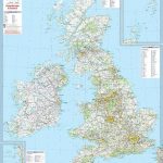
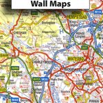
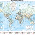
Great Britain: The Daily Telegraph Wall Map of Great Britain & Ireland
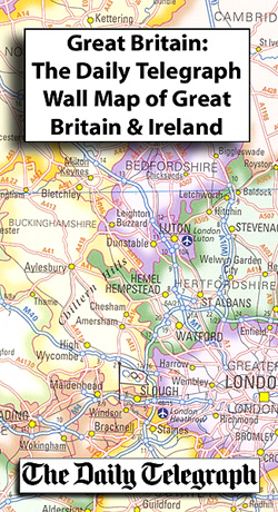
Political wall map of Great Britain and Ireland at 1:1,250,000 from The Daily Telegraph, produced by Roger Lascelles maps. Counties are marked with pale colours and subtle shading along the boundaries, with an inset showing London boroughs in greater detail.Road detail shows motorways and A roads with their names and junction numbers indicated; airports, ferry routes and railway lines are also highlighted. Beaches are subtly overprinted in yellow, whilst Olympic flags mark the prospective 2012 Olympic sites. Topography is shown through selected spot heights, with basic bathymetric shading used to show the sea floor.The map also includes an inset of the Great Britain and Ireland at 1:5,000,000, showing some relief shading and national parks and areas of outstanding natural beauty. Another inset shows the flags of the countries and information in area, population, and more.

Related Products:
 Great Britain: The Daily Telegraph Wall Map of Great Britain & Ireland (ENCAPSULATED)
 Great Britain & Ireland Michelin Wall Map PAPER
 Great Britain & Ireland Michelin Wall Map ENCAPSULATED
 Britain and Ireland NGS Classic Wall Map PAPER
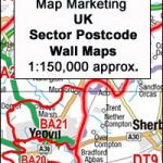 Great Britain & Northern Ireland: Map Marketing Postcode Sector Maps
 Britain and Ireland NGS Classic Wall Map ENCAPSULATED
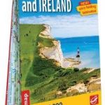
 I Love the Seaside Great Britain & Ireland: The Surf & Travel Guide to Great Britain & Ireland
 Where To Go When Great Britain & Ireland
 Britain and Ireland NGS Executive Wall Map PAPER
 Great Britain – Ireland Michelin Pocket Map
 Great Britain: Sustrans/CycleCity Cycling Maps of Great Britain & Northern Ireland
 Usborne Atlas and Jigsaw Great Britain and Ireland 300 Pieces
 Great Britain & Northern Ireland ReiseKnow-How Map
 Great Britain – Ireland Hallwag Road Map
 Great Britain & Ireland – World Heritage Sites
 Britain and Ireland NGS Executive Wall Map ENCAPSULATED
 Great Britain – Ireland F&B
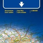
 Great Britain – Ireland ExpressMap
 Sticker Picture Atlas of Great Britain and Ireland
 Great Britain Borch
 Great Britain: A-Z Five Miles to One Inch Wall Maps
 Bradshaw`s Railway Map Great Britain and Ireland 1852
 Great Britain – Ireland IGN 86105
 Great Britain: A-Z Regional Wall Maps
 Great Britain – Ireland Marco Polo Road Atlas
 Great Britain – Ireland IGN Road Map ROY01
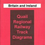 Great Britain and Ireland: Quail Railway Track Diagrams
 Great Britain-Ireland
 Rail Atlas of Great Britain and Ireland: 15
 Great Britain & Ireland 2022 Michelin 713
 Great Britain & Ireland 2021 Michelin
 Great Britain & Ireland Flexi Map
 USA Michelin Political Wall Map PAPER
 The Daily Telegraph World Political Wall Map PAPER
 Bradshaw`s Great Britain & Ireland Handbook 1863
 Cicerone Great Britain & Ireland Cycling Guides
 Great Britain and Ireland: Godfrey Editions of Historical Ordnance Survey 25″ Street Plans
 Great Britain & Ireland Michelin Red Guide 2020
 Great Britain & Northern Ireland: Philip`s County Street Atlases