Disclosure : This site contains affiliate links to products. We may receive a commission for purchases made through these links.
Categories
-
Best Sellers
-

Finnskogen South Nordeca 2676
Finnskogen South area in Norway in a series of GPS compatible recreational maps at 1:50,000 with cartography from Norway’s topographic survey and additional tourist information. Contours Read More » -

Mars
All eyes are on Mars. NASA`s new lander, InSight, has touched down on the red planet, and in two years Mars 2020 rover will depart Cape Read More » -

Drei Schwestern Swisstopo 1136
Map No. 1136, Drei Schwestern, in the topographic survey of Switzerland at 1:25,000 from Bundesamt fรผr Landestopographie (swisstopo), covering the whole country on 247 small format Read More » -

Fingerprint Activities Christmas
This activity book with seven coloured ink pads is full of pictures to complete with festive fingerprinting, including decorating a Christmas tree and Christmas stockings, gingerbread Read More » -
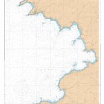
SHOM Chart 7316 – Golfe de Sagone
PLEASE NOTE: the chart will be ordered for you if not currently in stock. Please allow 1-2 weeks for the chart to reach Stanfords. SHOM charts Read More » -

Rias de Ferrol – Ares – Betanzos and A Coruna CNIG Map
The coast of Galicia between the towns of A Coruรฑa and Ferrol on a detailed, GPS compatible topographic map at 1:50,000 from the country’s civilian survey Read More » -

Donegal SW OSI Discovery 10
Map No. 10, Donegal South-West in the Discovery series from the OSI, the Ordnance Survey of Ireland, which presents the country on detailed topographic maps at Read More » -

Wales Coast Path Official Guide 5: Pembrokeshire: Cardigan to Amroth
This new, fully revised and updated edition is one of seven Official Guides to the Wales Coast Path. This guide breaks the Pembrokeshire section – from Read More » -

Stanford`s Pacific-centred World Map (1884) – A4 Wall Map, Canvas
The Stanford’s Pacific-centred World Map is from a fascinating series of reproductions from our Edward Stanford Cartographic Collection archive.Originally published in 1884, this political wall map Read More » -

Engelberg
Engelberg area including Urnersee, Giswil, Sarnen, Alpnach, Stans and Buochs at 1:50,000 in a series from Hallwag covering Switzerland’s popular hiking regions on light, waterproof and Read More »
-


