Disclosure : This site contains affiliate links to products. We may receive a commission for purchases made through these links.
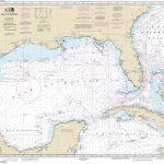
SHOM Charts for the Gulf of Mexico – Caribbean Sea

Related Products:
 Gulf of Mexico and the Caribbean coast Mexican SEMAR charts
 SEMAR Chart 4 – Gulf of Mexico and Caribbean Sea
 Admiralty Routeing Chart 5142(5) – Gulf of Mexico and Caribbean Sea – May
 Admiralty Routeing Chart 5142(1) – Gulf of Mexico and Caribbean Sea – January
 Admiralty Routeing Chart 5142(3) – Gulf of Mexico and Caribbean Sea – March
 Admiralty Routeing Chart 5142(2) – Gulf of Mexico and Caribbean Sea – February
 Admiralty Routeing Chart 5142(4) – Gulf of Mexico and Caribbean Sea – April
 Admiralty Routeing Chart 5142(6) – Gulf of Mexico and Caribbean Sea – June
 Admiralty Routeing Chart 5142(7) – Gulf of Mexico and Caribbean Sea – July
 Admiralty Routeing Chart 5142(8) – Gulf of Mexico and Caribbean Sea – August
 Admiralty Routeing Chart 5142(9) – Gulf of Mexico and Caribbean Sea – September
 Admiralty Routeing Chart 5142(10) – Gulf of Mexico and Caribbean Sea – October
 Admiralty Routeing Chart 5142(11) – Gulf of Mexico and Caribbean Sea – November
 Admiralty Routeing Chart 5142(12) – Gulf of Mexico and Caribbean Sea – December
 SHOM Charts for the West Coast of Africa – Gulf of Guinea
 NV Charts – Caribbean Sea
 Imray-Iolaire Charts: The Caribbean
 NOAA Charts for Atlantic and Gulf Coasts
 Central America – Caribbean Islands – Mexico
 Admiralty Chart Folio 83 – Gulf of Mexico – Including part of the Bahamas and Cuba
 Cruising Guide Belize Mexico Caribbean Coast 3RD ED
 NOAA Chart 411 – Gulf of Mexico
 Admiralty Chart 4401 – Gulf of Mexico
 Western Mexico – Charlie`s Charts Cruising Guide
 Mariners` Routeing Guide 5520 – Gulf of Mexico
 NP69A East Coasts of Central America and Gulf of Mexico Pilot
 NP69A East Coasts of Central America and Gulf of Mexico Pilot – Digital
 NOAA Chart 11365 – Barataria and Bayou Lafourche Waterways’”Intracoastal Waterway to Gulf of Mexico
 SHOM Charts for the Channel (Center)
 SHOM Charts for the Channel (West)
 SHOM Charts for Vanuatu – New Caledonia
 SHOM Charts for French Polynesia
 SHOM Routeing Charts for the Pacific Ocean
 SHOM Routeing Charts for the Atlantic Ocean
 SHOM Charts for Ireland and Western England
 SHOM Charts for North Sea, Pas de Calais, the Channel
 SHOM Charts for the West Coast of France
 SHOM Charts for the Tyrrhenian Sea – Ionian Sea – Adriatic Sea
 SHOM Charts for the Black Sea – Marmara Sea – Mediterranean Sea
 SHOM Charts for the Azores – West Coast of Africa


