Disclosure : This site contains affiliate links to products. We may receive a commission for purchases made through these links.
SHOM Charts for the Tyrrhenian Sea – Ionian Sea – Adriatic Sea


Related Products:
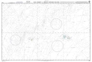
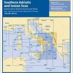 M30 South Adriatic and Ionian Seas
 SHOM Charts for the Channel (Center)
SHOM Charts for the Channel (West)
SHOM Charts for Vanuatu – New Caledonia
SHOM Charts for French Polynesia
SHOM Routeing Charts for the Pacific Ocean
SHOM Routeing Charts for the Atlantic Ocean
SHOM Charts for Ireland and Western England
SHOM Charts for North Sea, Pas de Calais, the Channel
SHOM Charts for the West Coast of France
SHOM Charts for the Black Sea – Marmara Sea – Mediterranean Sea
SHOM Charts for the Gulf of Mexico – Caribbean Sea
SHOM Charts for the Azores – West Coast of Africa
SHOM Charts for Spain – Portugal – The Strait of Gibraltar – The Alboran Sea
SHOM Charts for the East Coast of Spain – Balearic Islands
SHOM Charts for North Africa: Algeria, Tunisia, Libya
SHOM Charts for the West Coast of Africa – Gulf of Guinea
SHOM Charts for the Aegean Sea – Greece – Turkey – North Coast of Africa
SHOM Charts for South Africa – Indian Ocean – Mozambique Canal
SHOM Charts for the South West Coast of France – North Coast of Spain
SHOM Charts for the North East Atlantic, North Sea, Baltic Sea, Mediterranean Sea
SHOM Charts for the Channel (Center)
SHOM Charts for the Channel (West)
SHOM Charts for Vanuatu – New Caledonia
SHOM Charts for French Polynesia
SHOM Routeing Charts for the Pacific Ocean
SHOM Routeing Charts for the Atlantic Ocean
SHOM Charts for Ireland and Western England
SHOM Charts for North Sea, Pas de Calais, the Channel
SHOM Charts for the West Coast of France
SHOM Charts for the Black Sea – Marmara Sea – Mediterranean Sea
SHOM Charts for the Gulf of Mexico – Caribbean Sea
SHOM Charts for the Azores – West Coast of Africa
SHOM Charts for Spain – Portugal – The Strait of Gibraltar – The Alboran Sea
SHOM Charts for the East Coast of Spain – Balearic Islands
SHOM Charts for North Africa: Algeria, Tunisia, Libya
SHOM Charts for the West Coast of Africa – Gulf of Guinea
SHOM Charts for the Aegean Sea – Greece – Turkey – North Coast of Africa
SHOM Charts for South Africa – Indian Ocean – Mozambique Canal
SHOM Charts for the South West Coast of France – North Coast of Spain
SHOM Charts for the North East Atlantic, North Sea, Baltic Sea, Mediterranean Sea
 NOAA Charts for Alaska Coast (Planning Charts)
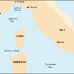 M40 Ligurian and Tyrrhenian Seas
 Admiralty Chart 805 – Ports in the Tyrrhenian Sea
 NGA Chart 53031 – Golfe du Lion to Tyrrhenian Sea
 Ionian Islands Orama Editions 058
 Ionian
 By The Ionian Sea
 M50 Sardegna to Ionian Sea
 The Ionian Islands
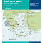 G12 South Ionian Islands
 G11 North Ionian Islands
Admiralty Chart Folio 27 – Adriatic and West Coast of Greece
G11 North Ionian Islands
Admiralty Chart Folio 27 – Adriatic and West Coast of Greece
 M10 Western Mediterranean – Gibraltar to the Ionian Sea
 DK Eyewitness Top 10 Corfu and the Ionian Islands
 The Ionian Islands & Epirus – A Cultural History
 Greece Sea Guide Vol III – Ionian Sea, Peloponnisos (except East coast)
 Adriatic Pilot
 M32 Adriatic Italy South
 Adriatic Sea Pilot Volume 1