Disclosure : This site contains affiliate links to products. We may receive a commission for purchases made through these links.
Planning Charts for Arctic Coast of Canada
Canadian Hydrographic Service charts covering large areas of the Arctic coast of Canada, ideal for planning routes.
Related Products:
 Planning Charts for Atlantic Coast of Canada
 Planning Charts for Pacific Coast of Canada
 Labrador Coast Charts
 New Brunswick Coast Charts
 NOAA Charts for Alaska Coast (Planning Charts)
 West Coast of Vancouver Island and Queen Charlotte Sound Charts
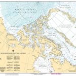 CHS Chart 7000 – Arctic Archipelago
 Charts for Hudson Bay, Baffin Island and Adjacent waters
 Charts for the Arctic Archipelago and Nunavut
 Admiralty Chart 4006 – Arctic Region Planning Chart
 CHS Chart 4506 – Plans in the Vicinity of Canada Bay
 CHS Chart 4538 – Canada Bay including Chimney Bay
 Charts for Haida Gwaii
 Newfoundland Coast including St Pierre and Miquelon
 CHS Chart 4583 – St Julien Island to Hooping Harbour including Canada Bay
 Charts for Juan de Fuca, Johnstone and Georgia Straits
 CHS Chart 4507 – Northeast Coast of Newfoundland
 CHS Chart 4712 – Plans on the Coast of Labrador
 Quebec, St Lawrence River and Anticosti Island Charts
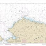 NOAA Chart 16003 – Arctic Coast
 CHS Chart 4505 – Planson the East Coast of the Island of Newfoundland
 CHS Chart 3860 – Harbours on the West Coast of Graham Island
 Pacific Coast Mexican SEMAR charts
 Gulf of Mexico and the Caribbean coast Mexican SEMAR charts
 Canada Lonely Planet Planning Map
 SHOM Charts for the South West Coast of France – North Coast of Spain
 CHS Chart 3311 – Sunshine Coast, Vancouver Harbour to Desolation Sound
 General and Regional Mexican SEMAR charts
 Canada: ITMB/Canada Map Office Topographic Maps of British Columbia and the Rockies
 Canada
 Greenland and the European Arctic BAS
 SHOM Charts for the West Coast of France
 Greenland and the European Arctic BAS Wall Map
 SEMAR Chart 001 – Zona Economica Exclusiva – Mexico Coast and Approaches
 SHOM Charts for the Azores – West Coast of Africa
 Coast to Coast Path (Trailblazer British Walking Guide): 109 Large-Scale Walking Maps & Guides to 33 Towns & Villages – Planning, Places to Stay, Places to Eat – St Bees to Robin Hood`s Bay
 Natural Resources Canada North Circumpolar Region Wall Map – Bilingual – Atlas of Canada 1087 x 921 mm
 SHOM Charts for the West Coast of Africa – Gulf of Guinea
 SHOM Charts for the East Coast of Spain – Balearic Islands
 North America Michelin Large Format Atlas 2021 – USA – Canada – Mexico


