Disclosure : This site contains affiliate links to products. We may receive a commission for purchases made through these links.
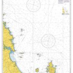
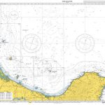
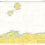
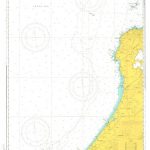
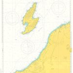
Admiralty Chart Folio 63 – Northwest Coast of Australia Gulf of Carpentaria to Cape Cuvier

Related Products:
 Admiralty Chart Folio 64 – Southwest Coast of Australia – Cape Cuvier to Great Australian Bight
Admiralty Chart Folio 20 – Northwest Coast of Africa – Strait of Gibraltar to Sierra Leone incl. Madeira, Canary, and Cape Verde Islands
Admiralty Chart Folio 65 – Southeast Coast of Australia – Tasmania from Great Australian Bight to Sydney
Admiralty Chart Folio 89 – West Coast of Central America and the United States – Mariato Point to Cape Mendocino
Admiralty Chart Folio 90 – West Coast North America – Cape Mendocino to Vancouver Island including West Coast of Vancouver Island
Admiralty Chart Folio 64 – Southwest Coast of Australia – Cape Cuvier to Great Australian Bight
Admiralty Chart Folio 20 – Northwest Coast of Africa – Strait of Gibraltar to Sierra Leone incl. Madeira, Canary, and Cape Verde Islands
Admiralty Chart Folio 65 – Southeast Coast of Australia – Tasmania from Great Australian Bight to Sydney
Admiralty Chart Folio 89 – West Coast of Central America and the United States – Mariato Point to Cape Mendocino
Admiralty Chart Folio 90 – West Coast North America – Cape Mendocino to Vancouver Island including West Coast of Vancouver Island
 Admiralty Chart NZ52 – Cape Brett to Cuvier Island
 Admiralty Chart NZ54 – Cuvier Island to East Cape
Admiralty Chart Folio 57 – Northwest Pacific Ocean
Admiralty Chart Folio 40 – Persian Gulf
Admiralty Chart Folio 11 – Gulf of Finland and Bothnia
Admiralty Chart Folio 32 – Red Sea, Gulf of Aden and Arabian Sea
Admiralty Chart Folio 26 – West Coast of Italy – Toulon to Messina Strait and North Coast of Sicily
Admiralty Chart Folio 17 – West Coast of France and North Coast of Spain, Chaussee de Sein to Golfo de Foz
Admiralty Chart NZ54 – Cuvier Island to East Cape
Admiralty Chart Folio 57 – Northwest Pacific Ocean
Admiralty Chart Folio 40 – Persian Gulf
Admiralty Chart Folio 11 – Gulf of Finland and Bothnia
Admiralty Chart Folio 32 – Red Sea, Gulf of Aden and Arabian Sea
Admiralty Chart Folio 26 – West Coast of Italy – Toulon to Messina Strait and North Coast of Sicily
Admiralty Chart Folio 17 – West Coast of France and North Coast of Spain, Chaussee de Sein to Golfo de Foz
 NGA Chart 73020 – Halmahera to Gulf of Carpentaria
Admiralty Chart Folio 83 – Gulf of Mexico – Including part of the Bahamas and Cuba
Admiralty Chart Folio 56 – Korean Gulf, Siberia, Sakhalin and Kuril Islands
NGA Chart 73020 – Halmahera to Gulf of Carpentaria
Admiralty Chart Folio 83 – Gulf of Mexico – Including part of the Bahamas and Cuba
Admiralty Chart Folio 56 – Korean Gulf, Siberia, Sakhalin and Kuril Islands
 Admiralty Chart JP179 – Nippon, Honshu-Northwest Coast & Kyushu-North Coast
Admiralty Chart JP201 – Nippon, Kyushu – North Coast & Honshu – Northwest Coast
Admiralty Chart Folio 13 – West Coast of Norway
Admiralty Chart Folio 80 – Atlantic Coasts of Cape Bretton Island, Scotia and Bay of Fundy
Admiralty Chart Folio 27 – Adriatic and West Coast of Greece
Admiralty Chart Folio 81 – East Coast of the United States
Admiralty Chart Folio 41 – Pakistan and West Coast of India
Admiralty Chart JP179 – Nippon, Honshu-Northwest Coast & Kyushu-North Coast
Admiralty Chart JP201 – Nippon, Kyushu – North Coast & Honshu – Northwest Coast
Admiralty Chart Folio 13 – West Coast of Norway
Admiralty Chart Folio 80 – Atlantic Coasts of Cape Bretton Island, Scotia and Bay of Fundy
Admiralty Chart Folio 27 – Adriatic and West Coast of Greece
Admiralty Chart Folio 81 – East Coast of the United States
Admiralty Chart Folio 41 – Pakistan and West Coast of India
 Admiralty Chart 3113 – Cape Three Points to Cape Coast
Admiralty Chart Folio 97 – Magellan Strait, Cape Horn, Patagonian Channels and Arctic Peninsula
Admiralty Chart Folio 2 – Bristol Channel and South Coast of Ireland
Admiralty Chart Folio 16 – North Coast of France and the Channel Islands
Admiralty Chart Folio 3 – Irish Sea ‘“ Firth of Clyde and North Coast of Ireland
Admiralty Chart Folio 18 – West Coast of Spain, Portugal, Strait of Gibraltar
Admiralty Chart 3113 – Cape Three Points to Cape Coast
Admiralty Chart Folio 97 – Magellan Strait, Cape Horn, Patagonian Channels and Arctic Peninsula
Admiralty Chart Folio 2 – Bristol Channel and South Coast of Ireland
Admiralty Chart Folio 16 – North Coast of France and the Channel Islands
Admiralty Chart Folio 3 – Irish Sea ‘“ Firth of Clyde and North Coast of Ireland
Admiralty Chart Folio 18 – West Coast of Spain, Portugal, Strait of Gibraltar
 Admiralty Chart JP1172 – Northwest Coast, Taisha Ko to Tottori Ko
Admiralty Chart JP139 – Northwest Coast, Tottori Ko to Fukui Ko
Admiralty Chart JP1172 – Northwest Coast, Taisha Ko to Tottori Ko
Admiralty Chart JP139 – Northwest Coast, Tottori Ko to Fukui Ko
 Admiralty Chart JP145 – Northwest Coast, Niigata Ko to Oga Honto
Admiralty Chart JP149 – Northwest Coast, Tsunoshima to Taisha Ko
Admiralty Chart JP145 – Northwest Coast, Niigata Ko to Oga Honto
Admiralty Chart JP149 – Northwest Coast, Tsunoshima to Taisha Ko
 Admiralty Chart JP1169 – Northwest Coast, Fukui Ko to Wajima Ko
 Admiralty Chart JP1195 – Nippon, Honshu-Northwest Coast
Admiralty Chart Folio 4 – West Coast of Ireland from Kenmare River to Bloody Foreland
Admiralty Chart Folio 98 – West Coast of South America – Chonos Archipelago to Buenaventura
Admiralty Chart Folio 59 – South and East Coasts of Borneo and West Coast of Sulawesi
Admiralty Chart Folio 43 – East Coast of India – Bangladesh, Burma and Andaman Islands
Admiralty Chart JP1195 – Nippon, Honshu-Northwest Coast
Admiralty Chart Folio 4 – West Coast of Ireland from Kenmare River to Bloody Foreland
Admiralty Chart Folio 98 – West Coast of South America – Chonos Archipelago to Buenaventura
Admiralty Chart Folio 59 – South and East Coasts of Borneo and West Coast of Sulawesi
Admiralty Chart Folio 43 – East Coast of India – Bangladesh, Burma and Andaman Islands
 Admiralty Chart JP1180 – Northwest Coast, Sado Kaikyo & Approaches