Disclosure : This site contains affiliate links to products. We may receive a commission for purchases made through these links.
Dipton 1916

Dipton in 1916 in a fascinating series of reproductions of old Ordnance Survey plans in the Alan Godfrey Editions, ideal for anyone interested in the history of their neighbourhood or family. The map covers the village of Dipton, historically made up of three parts: Pontop, Collierley and Dipton. Features include South Medomsley Colliery (traditionally called High Stables), Delight Colliery, Dipton Colliery, Pontop Hall, Mary Pit, Coronation Drift, Main Coal Drift, Brass Thill Drift, tramways to the drifts, St John`s church, High Collierley, Pontop Quarry, Pontop & Jarrow Railway, Curry`s Square, St Patrick`s RC church, site of Lily Colliery, Harelaw Quarry, two picture theatres, old pits, etc. On the reverse are directories of Dipton in 1894 and 1906. About the Alan Godfrey Editions of the 25″ OS Series:Selected towns in Great Britain and Ireland are covered by maps showing the extent of urban development in the last decades of the 19th and early 20th century. The plans have been taken from the Ordnance Survey mapping and reprinted at about 15 inches to one mile (1:4,340). On the reverse most maps have historical notes and many also include extracts from contemporary directories. Most maps cover about one mile (1.6kms) north/south, one and a half miles (2.4kms) across; adjoining sheets can be combined to provide wider coverage.FOR MORE INFORMATION AND A COMPLETE LIST OF ALL AVAILABLE TITLES PLEASE CLICK ON THE SERIES LINK.

Related Products:
 Sacriston 1897
Annfield Plain 1896
Hamilton 1896
Stanley 1895
Stanley 1915
Ashton-under-Lyne 1916
Burnhope 1895
Gateshead Fell & Sheriff Hill 1895 – 7.05a
Sacriston 1897
Annfield Plain 1896
Hamilton 1896
Stanley 1895
Stanley 1915
Ashton-under-Lyne 1916
Burnhope 1895
Gateshead Fell & Sheriff Hill 1895 – 7.05a
 Shut End and Tansey Green 1903
Burnopfield and The Leazes 1895
Trimdon Grange 1914
Moss Valley and Gwersyllt 1909
Shut End and Tansey Green 1903
Burnopfield and The Leazes 1895
Trimdon Grange 1914
Moss Valley and Gwersyllt 1909
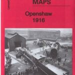 Openshaw 1916
Ryhope Village 1895
Denbigh 1910
Openshaw 1916
Ryhope Village 1895
Denbigh 1910
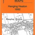 Hanging Heaton 1892
Pelton and Urpeth 1895
Felling 1894
Hanging Heaton 1892
Pelton and Urpeth 1895
Felling 1894
 Grimethorpe 1929
 New Hartley and Delaval Hall 1896
Pedmore 1921
Horsehay and Dawley 1901
Byker and Heaton 1913
Byker and Heaton 1895
Eston 1927
Lye 1914
New Hartley and Delaval Hall 1896
Pedmore 1921
Horsehay and Dawley 1901
Byker and Heaton 1913
Byker and Heaton 1895
Eston 1927
Lye 1914
 Salford Docks 1916
South Shields 1895
Drumsagard Hallside & Newton 1896 – 11.06
Hindley Green 1906
Hetton Downs and Rainton Bridge 1895
Salford Docks 1916
South Shields 1895
Drumsagard Hallside & Newton 1896 – 11.06
Hindley Green 1906
Hetton Downs and Rainton Bridge 1895
 Wirksworth 1920
 Bollington 1907
Pontnewynydd 1899
Llanberis 1913 – 16.08
Wakefield West 1905
Lampeter 1904
Pelton Fell 1915
Jarrow 1912
Bollington 1907
Pontnewynydd 1899
Llanberis 1913 – 16.08
Wakefield West 1905
Lampeter 1904
Pelton Fell 1915
Jarrow 1912
 Sedgley South-East with Swan Village and West Coseley 1901