Disclosure : This site contains affiliate links to products. We may receive a commission for purchases made through these links.
Admiralty Chart Folio 83 – Gulf of Mexico – Including part of the Bahamas and Cuba
Related Products:
 Admiralty Chart 4404 – Gulf of Maine to Strait of Belle Isle including Gulf of St. Lawrence
 Admiralty Chart Folio 84 – Eastern and Southern Coasts of Cuba
 Admiralty Chart Folio 40 – Persian Gulf
 Admiralty Chart Folio 11 – Gulf of Finland and Bothnia
 Admiralty Chart Folio 32 – Red Sea, Gulf of Aden and Arabian Sea
 Admiralty Chart Folio 56 – Korean Gulf, Siberia, Sakhalin and Kuril Islands
 Admiralty Chart 4401 – Gulf of Mexico
 Admiralty Chart Folio 63 – Northwest Coast of Australia Gulf of Carpentaria to Cape Cuvier
 Admiralty Routeing Chart 5142(5) – Gulf of Mexico and Caribbean Sea – May
 Admiralty Routeing Chart 5142(1) – Gulf of Mexico and Caribbean Sea – January
 Admiralty Routeing Chart 5142(3) – Gulf of Mexico and Caribbean Sea – March
 Admiralty Routeing Chart 5142(2) – Gulf of Mexico and Caribbean Sea – February
 Admiralty Routeing Chart 5142(4) – Gulf of Mexico and Caribbean Sea – April
 Admiralty Routeing Chart 5142(6) – Gulf of Mexico and Caribbean Sea – June
 Admiralty Routeing Chart 5142(7) – Gulf of Mexico and Caribbean Sea – July
 Admiralty Routeing Chart 5142(8) – Gulf of Mexico and Caribbean Sea – August
 Admiralty Routeing Chart 5142(9) – Gulf of Mexico and Caribbean Sea – September
 Admiralty Routeing Chart 5142(10) – Gulf of Mexico and Caribbean Sea – October
 Admiralty Routeing Chart 5142(11) – Gulf of Mexico and Caribbean Sea – November
 Admiralty Routeing Chart 5142(12) – Gulf of Mexico and Caribbean Sea – December
 Admiralty Chart 4403 – Southeast Coast of North America including the Bahamas and Greater Antilles
 Admiralty Chart 2996 – Cuba to Bahama Islands Including Straits of Florida
 Admiralty Chart 1998 – Nice to Livorno including Gulf of Genoa
 Admiralty Chart 4488 – Tayabas Bay to Burias Pass including Ragay Gulf
 Admiralty Chart 2040 – Baltic Sea, Stilo to Klaipeda including Gulf of Gdansk
 Admiralty Chart 4620 – Percy Isles to Booby Island including Gulf of Papua
 SHOM Chart 7473 – De Florida ร Cuba – Bahamas Islands
 Admiralty Chart 662 – Isla de Guanaja to Isla Cozumel including the Gulf of Honduras
 Admiralty Chart NZ53 – North Island – East Coast, Bream Head to Slipper Island including Hauraki Gulf
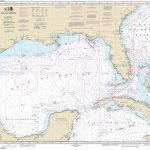 NOAA Chart 411 – Gulf of Mexico
 SEMAR Chart 4 – Gulf of Mexico and Caribbean Sea
 Admiralty Chart AUS485 – Spencer Gulf and Gulf of St Vincent
 ADMIRALTY Leisure Folio SC 5613 – Irish Sea, Eastern Part including Isle of Man
 Admiralty Chart Folio 90 – West Coast North America – Cape Mendocino to Vancouver Island including West Coast of Vancouver Island
 ADMIRALTY Leisure Folio SC 5609 – North West Wales including Menai Straits
 NOAA Chart 11365 – Barataria and Bayou Lafourche Waterways’”Intracoastal Waterway to Gulf of Mexico
 SEMAR Chart 010 – Ensenada to Mazatlan, Including California Gulf
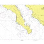 SEMAR Chart 300 – Punta San Pablo to Mazatlan, including south of California Gulf
 Maritime Security Chart Q6114 – West Africa including Gulf of Guinea
 SHOM Charts for the Gulf of Mexico – Caribbean Sea


