Disclosure : This site contains affiliate links to products. We may receive a commission for purchases made through these links.
Admiralty Chart Folio 86 – West Indies Islands from San Salvador and Jamaica to Antigua
Related Products:
 Admiralty Chart 2943 – West Indies, Jamaica and Pedro Bank
 Admiralty Chart 1043 – West Indies – St. Lucia to Grenada, Windward Islands
 NGA Chart 26328 – West Indies – The Bahamas – Berry Islands
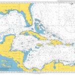 Admiralty Chart 4400 – The West Indies
 ADMIRALTY Leisure Folio SC 5616 – Scotland West Coast, Point of Ardnamurchan to Shiant Islands
 Admiralty Chart 1042 – West Indies – Montserrat to St. Lucia, Lesser Antilles
 Admiralty Chart Folio 15 – Faeroes Islands, Iceland and Spitsbergen
 Admiralty Chart Folio 13 – West Coast of Norway
 Admiralty Chart Folio 76 – Labrador and West Greenland
 Admiralty Chart Folio 16 – North Coast of France and the Channel Islands
 Admiralty Chart Folio 27 – Adriatic and West Coast of Greece
 Admiralty Chart Folio 41 – Pakistan and West Coast of India
 Admiralty Chart Folio 70 – Fiji, Tonga, Samoa, Ellice and Gilbert Islands
 Admiralty Chart Folio 74 – Northeast Pacific Ocean incl. Hawaiian Islands
 Admiralty Chart Folio 50 – Hong Kong Islands to Yangtze Kiang and Taiwan
 Admiralty Chart Folio 56 – Korean Gulf, Siberia, Sakhalin and Kuril Islands
 Admiralty Chart Folio 58 – E Sulawesi to Western New Guinea – Southeastern Part of Philippine Islands
 Admiralty Chart Folio 43 – East Coast of India – Bangladesh, Burma and Andaman Islands
 Admiralty Chart Folio 18 – West Coast of Spain, Portugal, Strait of Gibraltar
 Admiralty Chart Folio 100 – Antarctic – Prince Edward, Crozet, Heard, McDonald & Kerguelen Islands
 Admiralty Chart Folio 4 – West Coast of Ireland from Kenmare River to Bloody Foreland
 Admiralty Chart Folio 98 – West Coast of South America – Chonos Archipelago to Buenaventura
 Admiralty Chart Folio 59 – South and East Coasts of Borneo and West Coast of Sulawesi
 Admiralty Chart Folio 36 – East Coast of Africa – Delagoa Bay to Ras Hajun incl. Comoro and Seychelled Islands
 Admiralty Chart Folio 71 – New Zealand ‘“ North Island and Cook Strait Incl. Kermadec and Chatham Islands
 The Sugar Islands: A Collection of Pieces Written About the West Indies Between 1928 and 1953
 Admiralty Chart Folio 6 – North and South Coasts of Scotland From Lewis to Firth of Forth incl. Orkney and Shetland Islands
 Admiralty Chart Folio 66 – Sydney to Torres Strait, incl. Off-Lying reefs, Norfolk and Lord Howe Islands
 Admiralty Chart Folio 5 – West Coast of Scotland From Mull to Kintyre to Loch Broom incl. part of the Hebrides
 Admiralty Chart Folio 89 – West Coast of Central America and the United States – Mariato Point to Cape Mendocino
 Admiralty Chart Folio 25 – Mediterranean Coasts of Spain and France, Strait of Gibraltar to San Remo, incl. Balearic Islands, Corsica and Sardinia
 Admiralty Chart Folio 20 – Northwest Coast of Africa – Strait of Gibraltar to Sierra Leone incl. Madeira, Canary, and Cape Verde Islands
 Admiralty Chart Folio 90 – West Coast North America – Cape Mendocino to Vancouver Island including West Coast of Vancouver Island
 Admiralty Chart Folio 72 – New Zealand ‘“ South Island, South of Cook Strait incl. Macquaire and other off-lying islands
 Admiralty Chart Folio 26 – West Coast of Italy – Toulon to Messina Strait and North Coast of Sicily
 Admiralty Chart Folio 17 – West Coast of France and North Coast of Spain, Chaussee de Sein to Golfo de Foz
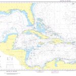 NGA Chart 400 – West Indies
 Admiralty Chart Folio 96 – East Coast of South America – Punta Piedras to Puerto Gallegos incl. Falkland Islands, South Georgia
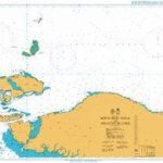 Admiralty Chart 3923 – North West Papua and Adjacent Islands
 Admiralty Chart AUS328 – Montebello Islands to North West Cape


