Disclosure : This site contains affiliate links to products. We may receive a commission for purchases made through these links.
Top 10 Walks: Loch Lomond & the Trossachs

Related Products:
 Lochside Walks: The Finest Waterside Walks in Loch Lomond & the Trossachs
 Hill Walks & Easy Summits: Walks on the Lower Hills of Loch Lomond & the Trossachs
 Loch Lomond & The Trossachs – Ben Lomond & Loch Katrine Harvey Superwalker XT25
 Pub Walks – The Best Pub Walks in Loch Lomond & Trossachs
 Day Walks in Loch Lomond & the Trossachs: 20 routes in the southern Scottish Highlands
 Walking Loch Lomond and the Trossachs: 70 walks, including 21 Munro summits
 Mountain Walks – Finest Mountain Walks in Loch Lomond & Trossachs
 Loch Lomond and The Trossachs
 PaddleMore in Loch Lomond and The Trossachs: A Guide for Canoes, Kayaks and SUPs
 Loch Lomond, The Trossachs: 2016
 Loch Lomond & the Trossachs V1: West
 Loch Lomond & The Trossachs Harvey Ultramap XT40
 Loch Lomond & the Trossachs National Park Outdoor Atlas
 Loch Lomond & Trossachs Mazzle – Jigsaw 1000 Pieces
 Walks around East Loch Lomond & Strathendrick
 Walks around West Loch Lomond & Clyde Sea Lochs
 Loch Lomond National Park Collins Pocket Map
 Walks around the Trossachs, Callander and Strathyre: 8 Easy to Follow Walks
 Loch Lomond & Inveraray OS Landranger Map 56 (paper)
 Loch Lomond & Cowal Way: with Isle of Bute
 Ben Venue – Loch Ard Forest & the Trossachs Harvey Superwalker
 Loch Lomond & Inveraray OS Landranger Active Map 56 (waterproof)
 Walking the Trossachs, Loch Lomondside and the Campsie Fells (14)
 Loch Lomond North – Tyndrum, Crianlarich & Arrochar OS Explorer Map OL39 (paper)
 Walks The Trossachs
 Loch Lomond South – Dumbarton, Helensburgh, Drymen & Cove OS Explorer Map OL38 (paper)
 Loch Lomond North – Tyndrum, Crianlarich & Arrochar OS Explorer Active Map OL39 (waterproof)
 Loch Lomond South – Dumbarton, Helensburgh, Drymen & Cove OS Explorer Active Map OL38 (waterproof)
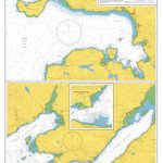
Admiralty Chart SC5610_10 – Loch Fyne – Continuation of Loch Fyne – Loch Gilp – Ardrishaig – Inveraray – Loch Gair
Loch Lomond South – Dumbarton, Helensburgh, Drymen & Cove OS Explorer Active Map OL38 (waterproof)
Admiralty Chart SC5610_10 – Loch Fyne – Continuation of Loch Fyne – Loch Gilp – Ardrishaig – Inveraray – Loch Gair
 Rides around Loch Lomond – 5 Easy to Follow Rides
Admiralty Chart SC5610_8 – Kyles of Bute – Caladh Harbour – Loch Riddon – Central Loch Striven – Upper Loch Striven
Rides around Loch Lomond – 5 Easy to Follow Rides
Admiralty Chart SC5610_8 – Kyles of Bute – Caladh Harbour – Loch Riddon – Central Loch Striven – Upper Loch Striven
 Admiralty Chart SC5610_1 – Loch Goil and Loch Long – Continuation of Loch Long – Largs Yacht Haven – Millport
 Admiralty Chart SC5610_2 – Southern Approaches to Loch Long Including Holy Loch – Continuation of Loch Long
 Admiralty Chart 2528 – Loch Gairloch Loch Kishorn and Loch Carron
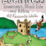 Loch Ness Inverness Black Isle and Affric: 40 favourite Walks
 Ben Alder, Loch Ericht & Loch Laggan – Dalwhinnie OS Explorer Map OL50 (paper)
 Knoydart, Loch Hourn & Loch Duich – Kyle of Lochalsh OS Explorer Map 413 (paper)
 Ardgour & Strontian – Glenfinnan, Loch Eil & Loch Shiel OS Explorer Active Map 391 (waterproof)
 Loch Alsh, Glen Shiel & Loch Hourn OS Landranger Active Map 33 (waterproof)
 Loch Alsh, Glen Shiel & Loch Hourn OS Landranger Map 33 (paper)