Disclosure : This site contains affiliate links to products. We may receive a commission for purchases made through these links.
Netherlands: 25K Topographic maps
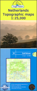
Trage Paden recreational maps providing extensive coverage of the Netherlands, with hiking and cycling routes on a topographic base, various types of terrain, recreational facilities, places of interest, etc. The individual maps are printed on waterproof and tear-resistant paper.Contours used in this map series vary between 2,5 to 5m according to the terrain, with 5m interval predominantly used for hilly areas. Varied colouring show different types of landscape: woods, vineyards, fields etc. An overprint highlights both the national long-distance walking routes and the shorter local circular trails, each clearly identified by a code and/or an abbreviation of its name. Recommended starting points for walks are designated by a symbol. Cycle lanes are visibly marked with a bike symbol; roads with heavy traffic are clearly indicated. Symbols indicate various facilities, such as railway and bus stations, coffee shops, campsites, country restaurants/bars, sport and leisure facilities. Maps have the lines of the Dutch National Grid for measuring distances and for determining location using GPS device and they are printed on weather resistant and tear-resistant paper. The legend is in Dutch only.

Related Products:
 Kaarten en Atlassen walking/ hiking maps: Netherlands
 Netherlands: ANWB 25K Topographic Survey Hiking Maps
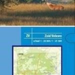
 Netherlands: Falk Maps of the Conservation Areas
 Netherlands: ANWB 50K Cycling Maps
 Netherlands: 25K Topographic Survey Maps
 Utrechtse Heuvelrug
 Amsterdam Waterland
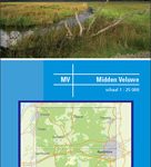 Central Veluwe
 Northwest Achterhoek
 Southwest Achterhoek
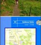 Gelderse Valley
 North Veluwe
 Amsterdam Amstelland
 Veluwe South
Germany: ADFC 75K/50K Regional Cycling Maps
Veluwe South
Germany: ADFC 75K/50K Regional Cycling Maps
 Switzerland: Swiss Survey 50K/33K Hiking Editions of Topographic Maps
 Reunion: IGN 25K Topographic Survey Maps
 Germany: Kรผmmerly+Frey Hiking and Recreational Maps
South Africa: Slingsby Maps Hiking Maps of the Cape Peninsula
Germany: Bavarian 25K Topographic Maps
Germany: Kรผmmerly+Frey Hiking and Recreational Maps
South Africa: Slingsby Maps Hiking Maps of the Cape Peninsula
Germany: Bavarian 25K Topographic Maps
 Netherlands: Falk Recreational Maps
 Canada: NGS Trails Illustrated Maps of Banff and Jasper
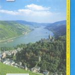
 Germany: Rhineland-Palatinate 50K Topographic Survey Recreational Maps
 Germany: Hesse 50K Topographic Survey Leisure Maps
 France: IGN 25K TOP25/Sรฉrie Bleue Topographic Survey Maps
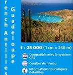 Guadeloupe/French Antilles: 25K Topographic Survey Maps
 Switzerland: Kรผmmerly + Frey 60K Cycling Maps
 Austria: Kรผmmerly+Frey Recreational Maps
 Sweden: Norstedts 1:50,000 – 1:75,000 Topographic maps
 Canada: ITMB/Canada Map Office Topographic Maps of British Columbia and the Rockies
 Greece: Terrain Editions Maps for Hiking and Recreational Pursuits
 Germany: Baden-Wรผrttemberg 50K Topographic Survey Leisure Maps
 Iceland: 250K Topographic Survey Road Maps
 Greece: Terrain Editions Maps of the Greek Islands
 Italy: Kรผmmerly + Frey Outdoor Maps of Northern Italy
 Denmark: 100K Topographic Survey Maps
 Germany: ADFC 150K Cycling Maps
 Lake Constance
 Great Britain: CroydeCycle Local Walking Maps of the West Country