Disclosure : This site contains affiliate links to products. We may receive a commission for purchases made through these links.
France: FFRP Topo-guides to Long-distance Footpaths
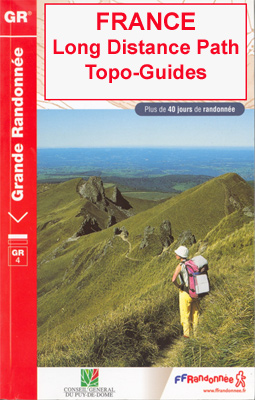
Light, high quality A5 paperback guides from the FFRP – the Fรฉdรฉration Franรงaise de la Randonnรฉe Pรฉdestre, to the long-distance GR hiking trails, with colour extracts from IGN`s 1:50,000 or 1:25,000 topographic survey maps overprinted with the route, plus a table indicating different facilities along the route, contact details for accommodation, etc.The GRs, Sentiers de Grande Randonnรฉe, form a dense network of footpaths across the French countryside, with several routes spanning the whole country. Particularly popular are the various pilgrim routes of the Way of St. James, the Alpine sections of the GR5, and the GR10 along the Pyrenees. Each topo-guide covers either one section of a longer path, a shorter connecting route, or a circular tour, as indicated by different colouring on our FFRP grid map for the whole series.The guides have colour extracts from IGN`s 1:50,000 and 1:25,000 topographic survey maps overprinted with the route. The descriptions of the route are divided into short sections according to the difficulty of the terrain, and are always placed next to the map extract for easy reference. ALL THE TEXT IS IN FRENCH but a large amount of information is conveyed by symbols. A table of all the main locations along the route indicates what facilities can be found there: public transport, food shops, and various types of accommodation (gรฎtes d`รฉtape, campsites, mountain refuges, hotels, etc.) with addresses and telephone numbers.HOW TO CHOOSE THE RIGHT REFERENCE NUMBER FROM THE FFRP GRID MAP: reference numbers of guides to the GR routes are shown in red boxes. A change in the colour of the route indicates a new guide, e.g. the GR10 along the Pyrenees is covered by four guides, Ref. Nos. from west to east 1086 (purple), 1091 (blue), 1090 (green) and 1092 (red).

Related Products:
 GRP: Tours et Ronde du Canigรณ FFRP Topo-guide No. 6600
 France: FFRP Topo-guides with Day Walks
 GR2: La Seine ร pied en Ile de France FFRP Topo-guide No. 203
 GR59/GR9/GRP: Tours et Traversรฉes de l`Ain FFRP Topo-guide No. 901
 GR654 Sentier St-Jacques: Perigueux – Roncevaux FFRP Topo-guide No. 6543
 GRP: La Haute Vallรฉe du Thorรฉ FFRP Topo-guide No. 812
 Great Britain & Ireland: Rucksack Readers` Guides to Long-distance Footpaths
 GR de Pays: Ouest des Vosges FFRP Topo-guide No. 881
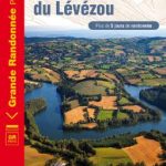 GRP: Monts et Lacs du Lรฉvรฉzou FFRP Topo-guide No. 1201
 GR3: Les Monts du Forez FFRP Topo-guide No. 334
 GRP: Ariรจge-Pyrรฉnรฉes ‘“ Andorre – Catalogne FFRP Topo-guide No. 1098
 GRP Robe de Bure et Cotte de Mailles FFRP Topo-guide No. 4303
 GR93/GR94 Tours dans les Hautes-Alpes FFRP Topo-guide No. 940
 GR36/36A: Traversรฉe de l`Aude – Pays Cathare FFRP Topo-guide No. 360
 GR145: The Via Francigena in Pas-de-Calais FFRP Topo-guide No. 1451
 GR9/GR96/GRP: Tours et Traversรฉes de Chartreuse FFRP Topo-guide No. 903
 GR de Pays: Tours en Hautes Terres d`Oc FFRP Topo-guide No. 811
 GR654 Chemins de St-Jacques: Vรฉzelay – Pรฉrigueux FFRP Topo-guide No. 6542
 France Long-Distance Footpaths (GRs) IGN 903
 GRP Tours dans le Pays Haut Languedoc et Vignobles FFRP Topo-guide No. 3400
 GR653D Chemins de St-Jacques: Montgenรจvre – Arles FFRP Topo-guide No. 6531
 GR430: Chemin de St-Regis – Entre Velay et Vivarais FFRP Topo-guide No. 430
 GR40: Tour des Volcans du Velay FFRP Topo-guide No. 425
 GR59/GR59A/GR559/GR509: L`Echappรฉe jurassienne FFRP Topo-guide No. 390
 GR62B/GR36/GR46 Le Chemin de Conques ร Toulouse FFRP Topo-guide No. 3646
 GR300: Randonnรฉes en Centre – Val-de-Loire de gare en gare FFRP Topo-guide No. 300
 GR46/GRP: Au pays du George Sand FFRP Topo-guide No. 361
 Pays Corbiรจres Minerovois ร pied FFRP Topo-guide No. P116
 GRP: Autour des Gorges de la Loire du Forez au Roannais FFRP Topo-guide No. 420
 Le Bois de Vincennes ร pied FFRP Topo-guide No. VI15
 Les Portes de Bretagne ร pied FFRP Topo-guide No. 355
Le Var ร pied FFRP Topo-guide D083
Les Portes de Bretagne ร pied FFRP Topo-guide No. 355
Le Var ร pied FFRP Topo-guide D083
 Les Monts du Beaujolais et du Lyonnais ร pied FFRP Topo-guide No. P691
 Pays du Lรฉon ร pied FFRP Topo-guide No. P296
 Les Marches du Velay ร pied FFRP Topo-guide No. P43D
 Le Pays de l`Emblavez ร pied FFRP Topo-guide No. P433
 Les Monts de Vaucluse ร pied FFRP Topo-guide No. P842
 Vals Aix et d`Isable ร pied FFRP Topo-guide No. P424
 Le Parc d`Armorique ร pied FFRP Topo-guide No. PN12
 La Cรดte Picarde ร pied FFRP Topo-guide No. P804