Disclosure : This site contains affiliate links to products. We may receive a commission for purchases made through these links.
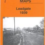
Viveros CNIG Topo 814-2


Related Products:
 Gor CNIG Topo 993-4
Ena CNIG Topo 209-1
Ara CNIG Topo 210-1
Foz CNIG Topo 9-4
Gor CNIG Topo 993-4
Ena CNIG Topo 209-1
Ara CNIG Topo 210-1
Foz CNIG Topo 9-4
 Ona CNIG Topo 136-3
Boniches CNIG Topo 636-2
Berzocana CNIG Topo 707-1
Kantabrana CNIG Topo 172-3
Maroto CNIG Topo 386-2
Fermoselle CNIG Topo 423-1
La Garrovilla CNIG Topo 777-1
Huesa CNIG Topo 949-1
Pastrana CNIG Topo 561-2
La Ventosa CNIG Topo 586-3
Huete CNIG Topo 608-1
Tresjuncos CNIG Topo 661-3
Paracuellos CNIG Topo 664-3
Ballesteros CNIG Topo 736-2
Villahermosa CNIG Topo 813-2
Cozar CNIG Topo 839-1
Nerpio CNIG Topo 909-2
Rabade CNIG Topo 72-2
O Irixo CNIG Topo 154-3
Destriana CNIG Topo 231-1
Villada CNIG Topo 234-2
Santovenia CNIG Topo 308-3
Solarana CNIG Topo 314-2
Lezaun CNIG Topo 140-2
Larraga CNIG Topo 173-3
Sarvise CNIG Topo 178-3
Cintruenigo CNIG Topo 282-3
Ferreira CNIG Topo 9-3
Cospeito CNIG Topo 47-4
Cebanico CNIG Topo 131-3
Villaviciosa CNIG Topo 30-1
Trespaderne CNIG Topo 136-1
Hontomin CNIG Topo 167-4
Sasamon CNIG Topo 199-1
Pampliega CNIG Topo 237-4
Palenzuela CNIG Topo 275-1
Ona CNIG Topo 136-3
Boniches CNIG Topo 636-2
Berzocana CNIG Topo 707-1
Kantabrana CNIG Topo 172-3
Maroto CNIG Topo 386-2
Fermoselle CNIG Topo 423-1
La Garrovilla CNIG Topo 777-1
Huesa CNIG Topo 949-1
Pastrana CNIG Topo 561-2
La Ventosa CNIG Topo 586-3
Huete CNIG Topo 608-1
Tresjuncos CNIG Topo 661-3
Paracuellos CNIG Topo 664-3
Ballesteros CNIG Topo 736-2
Villahermosa CNIG Topo 813-2
Cozar CNIG Topo 839-1
Nerpio CNIG Topo 909-2
Rabade CNIG Topo 72-2
O Irixo CNIG Topo 154-3
Destriana CNIG Topo 231-1
Villada CNIG Topo 234-2
Santovenia CNIG Topo 308-3
Solarana CNIG Topo 314-2
Lezaun CNIG Topo 140-2
Larraga CNIG Topo 173-3
Sarvise CNIG Topo 178-3
Cintruenigo CNIG Topo 282-3
Ferreira CNIG Topo 9-3
Cospeito CNIG Topo 47-4
Cebanico CNIG Topo 131-3
Villaviciosa CNIG Topo 30-1
Trespaderne CNIG Topo 136-1
Hontomin CNIG Topo 167-4
Sasamon CNIG Topo 199-1
Pampliega CNIG Topo 237-4
Palenzuela CNIG Topo 275-1