Disclosure : This site contains affiliate links to products. We may receive a commission for purchases made through these links.
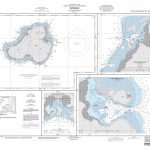
Aunon CNIG Topo 537-3


Related Products:
 Aunon CNIG Topo 537
 Gor CNIG Topo 993-4
Ena CNIG Topo 209-1
Ara CNIG Topo 210-1
Foz CNIG Topo 9-4
Ona CNIG Topo 136-3
Piedratajada CNIG Topo 285-1
O Oural CNIG Topo 124-3
Penalba CNIG Topo 386-3
Alcuescar CNIG Topo 729-4
Mirandilla CNIG Topo 752-4
El Almiceran CNIG Topo 949-2
Pulpi CNIG Topo 997-3
Sacedon CNIG Topo 562-1
Huelamo CNIG Topo 588-1
Talayuelas CNIG Topo 637-4
Alarcon CNIG Topo 691-3
Malagon CNIG Topo 736-4
Salamanca CNIG Topo 478-2
Oseira CNIG Topo 154-4
San Ciprian CNIG Topo 229-4
Pixeiros CNIG Topo 266-1
Arrabalde CNIG Topo 269-2
Villafafila CNIG Topo 308-4
Lodosa CNIG Topo 205-1
Cornago CNIG Topo 281-3
Puyarruego CNIG Topo 178-4
Castiliscar CNIG Topo 207-4
Tudela CNIG Topo 282-4
Viveiro CNIG Topo 8-2
Muimenta CNIG Topo 48-1
Paramo del Sil CNIG Topo 127-1
La Ercina CNIG Topo 130-2
Valdefresno CNIG Topo 162-1
Colunga CNIG Topo 30-2/15-4
Cerulleda CNIG Topo 79-3
Sotresgudo CNIG Topo 166-3
Villegas CNIG Topo 199-2
Amusco CNIG Topo 236-3
Ampudia CNIG Topo 311-3
Gor CNIG Topo 993-4
Ena CNIG Topo 209-1
Ara CNIG Topo 210-1
Foz CNIG Topo 9-4
Ona CNIG Topo 136-3
Piedratajada CNIG Topo 285-1
O Oural CNIG Topo 124-3
Penalba CNIG Topo 386-3
Alcuescar CNIG Topo 729-4
Mirandilla CNIG Topo 752-4
El Almiceran CNIG Topo 949-2
Pulpi CNIG Topo 997-3
Sacedon CNIG Topo 562-1
Huelamo CNIG Topo 588-1
Talayuelas CNIG Topo 637-4
Alarcon CNIG Topo 691-3
Malagon CNIG Topo 736-4
Salamanca CNIG Topo 478-2
Oseira CNIG Topo 154-4
San Ciprian CNIG Topo 229-4
Pixeiros CNIG Topo 266-1
Arrabalde CNIG Topo 269-2
Villafafila CNIG Topo 308-4
Lodosa CNIG Topo 205-1
Cornago CNIG Topo 281-3
Puyarruego CNIG Topo 178-4
Castiliscar CNIG Topo 207-4
Tudela CNIG Topo 282-4
Viveiro CNIG Topo 8-2
Muimenta CNIG Topo 48-1
Paramo del Sil CNIG Topo 127-1
La Ercina CNIG Topo 130-2
Valdefresno CNIG Topo 162-1
Colunga CNIG Topo 30-2/15-4
Cerulleda CNIG Topo 79-3
Sotresgudo CNIG Topo 166-3
Villegas CNIG Topo 199-2
Amusco CNIG Topo 236-3
Ampudia CNIG Topo 311-3