Disclosure : This site contains affiliate links to products. We may receive a commission for purchases made through these links.
Categories
-
Best Sellers
-

Kiruna Lantmateriet BD4
Mountain areas of central and northern Sweden on waterproof and tear-resistant, GPS compatible topographic ‘Fjรคllkartan” maps at 1:100,000 and 1:50,000 from Lantmรคteriet – the country’s national Read More » -

The Long Prospect
-

The Forging of a Rebel
The Forging of a Rebel is an unsurpassed account of Spanish history and society from early in the twentieth century through the cataclysmic events of the Read More » -

Instructional Chart 5054 – Flamborough Head to Blakeney Point
Admiralty Instructional charts are designed to be used for training. They contain all the features of a standard Admiralty nautical chart. PLEASE NOTE: instructional charts are Read More » -

What`s Where on Earth? Animal Atlas: The World`s Wildlife as You`ve Never Seen it Before
This stunning new atlas is your first class pass on a world tour of the homes of Earth`s most amazing animals. The latest exciting title in Read More » -

Eye – Stowmarket & District 1897 – 190
-
Mammoth Books
-

Barcelona: City Impressions
This book features emotive and inspiring images that capture the heart and soul of some the world`s most exciting and vibrant cities. City Impressions is an Read More » -

Lemnos Anavasi 10.30
Hiking map of Lรฉmnos island in a scale of 1:60.000A new detailed hiking map for Lรฉmnos in scale 1:60.000 by Anavasi editions with information on its Read More » -

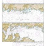
NOAA Chart 12364 – Long Island Sound’”New Haven Harbor Entrance and Port Jefferson to Throgs Neck
NOAA maintains the nautical charts and publications for U.S. coasts and the Great Lakes. Over a thousand charts cover 95,000 miles of shoreline and 3.4 million Read More »
-


