Disclosure : This site contains affiliate links to products. We may receive a commission for purchases made through these links.
Billingham South 1939
Billingham South in 1939 in a fascinating series of reproductions of old Ordnance Survey plans in the Alan Godfrey Editions, ideal for anyone interested in the history of their neighbourhood or family. The map covers the old village of Billingham, with St Cuthbert`s church and The Green in the top left corner. Coverage then extends south to the Billingham Beck and east to Haverton Hill Road and the Billingham Beck railway line. However, much of the map is taken up with the extraordinary industrial complex of ICI – Imperial Chemical Industries – which ran east from Chiltons Avenue. Billingham by 1939 was very much a company town. Also included is a historical introduction to Billingham from a 1894 map and a directory of the town in 1934.About the Alan Godfrey Editions of the 25″ OS Series:Selected towns in Great Britain and Ireland are covered by maps showing the extent of urban development in the last decades of the 19th and early 20th century. The plans have been taken from the Ordnance Survey mapping and reprinted at about 15 inches to one mile (1:4,340). On the reverse most maps have historical notes and many also include extracts from contemporary directories. Most maps cover about one mile (1.6kms) north/south, one and a half miles (2.4kms) across; adjoining sheets can be combined to provide wider coverage.FOR MORE INFORMATION AND A COMPLETE LIST OF ALL AVAILABLE TITLES PLEASE CLICK ON THE SERIES LINK.

Related Products:
 Mossend 1939 – 12.05
 Shotts (West) 1939 – 13.06
 Walthamstow (East) 1939 – 15.4
Ruislip 1939
Walthamstow (East) 1939 – 15.4
Ruislip 1939
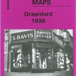 Greenford 1939
Motherwell (North) 1939 – 12.09
Carfin & Cleekhimin 1939 – 12.10
Greenford 1939
Motherwell (North) 1939 – 12.09
Carfin & Cleekhimin 1939 – 12.10
 Snaresbrook 1939
 Richmond South and Easby 1927
Barking (Upney) 1939
Rotherham South 1901
Richmond South and Easby 1927
Barking (Upney) 1939
Rotherham South 1901
 West Drayton South 1935
Colwyn Bay South East 1911
Sunderland South 1895
West Drayton South 1935
Colwyn Bay South East 1911
Sunderland South 1895
 South Norwood 1895
 Leeds South and South East 1906
Leeds South and South East 1890 (Colour Edition)
Leeds South and South East 1906
Leeds South and South East 1890 (Colour Edition)
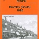 Bromley South 1895
 Watford South and New Bushey 1896
Enfield (South) 1895 – 7.07a
Watford South and New Bushey 1896
Enfield (South) 1895 – 7.07a
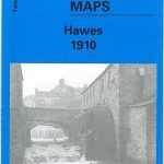 Hawes 1910
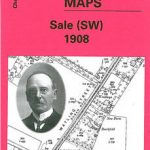 Sale South-West 1908
Colwyn Bay South West 1911
Sale South-West 1908
Colwyn Bay South West 1911
 Warwick (South) 1923
 Darlington (South) 1898 – 55.10a
South Dartmoor and the South Hams 1909
South Yardley and Hay Mills 1903
Darlington (South) 1898 – 55.10a
South Dartmoor and the South Hams 1909
South Yardley and Hay Mills 1903
 Beckenham South 1894
East Boldon 1895
Beckenham South 1894
East Boldon 1895
 Loughton (South) 1895 – 57.16
 South Croydon 1895 – 14.14
 South Croydon 1895 – 159.2
Northfield South 1903
Knutsford South 1908
South Croydon 1895 – 159.2
Northfield South 1903
Knutsford South 1908
 Beverley South 1908
East Jarrow 1913
Beverley South 1908
East Jarrow 1913
 St Albans South-West 1897
Barnsley South 1904
Gunnislake South and Albaston 1905
St Albans South-West 1897
Barnsley South 1904
Gunnislake South and Albaston 1905
 Sedgley South-East with Swan Village and West Coseley 1901