Disclosure : This site contains affiliate links to products. We may receive a commission for purchases made through these links.
Leyland 1909

Leyland in 1909 in a fascinating series of reproductions of old Ordnance Survey plans in the Alan Godfrey Editions, ideal for anyone interested in the history of their neighbourhood or family. The map covers the village of Leyland, stretching from Leyland Bleach Works eastward to Turpin Green, and from Golden Hill Lane southward to Rose Whittle Bridge. Features include Golden Hill, Brook Mills, Brookfield Iron Works, Motor Works, Turpin Green, Heald House Farm, Leyland village with St Andrew`s church, Wellington House, Old Hall, stretch of railway, etc. A 1918 directory of Leyland is on the reverse.About the Alan Godfrey Editions of the 25″ OS Series:Selected towns in Great Britain and Ireland are covered by maps showing the extent of urban development in the last decades of the 19th and early 20th century. The plans have been taken from the Ordnance Survey mapping and reprinted at about 15 inches to one mile (1:4,340). On the reverse most maps have historical notes and many also include extracts from contemporary directories. Most maps cover about one mile (1.6kms) north/south, one and a half miles (2.4kms) across; adjoining sheets can be combined to provide wider coverage.FOR MORE INFORMATION AND A COMPLETE LIST OF ALL AVAILABLE TITLES PLEASE CLICK ON THE SERIES LINK.

Related Products:
 Farington South and Leyland North 1909
Brymbo 1909
Bexenden 1909
Farington South and Leyland North 1909
Brymbo 1909
Bexenden 1909
 Great Driffield 1909
Accrington 1909
Great Driffield 1909
Accrington 1909
 North Chorley 1909 – 77.08
Blackpool Central Pier 1909
Wrexham Central 1909
Brades Village 1902 68.13a
North Chorley 1909 – 77.08
Blackpool Central Pier 1909
Wrexham Central 1909
Brades Village 1902 68.13a
 Rossall 1909
Wrexham North 1909
New Broughton and Stansty Hall 1909
Pollok Park 1909
Rhosllanerchrugog 1909
Oswaldtwistle and Church 1909
Cavan Town 1909
Bristol (St George) 1902 – 72.14
Rossall 1909
Wrexham North 1909
New Broughton and Stansty Hall 1909
Pollok Park 1909
Rhosllanerchrugog 1909
Oswaldtwistle and Church 1909
Cavan Town 1909
Bristol (St George) 1902 – 72.14
 Ayr 1909 – 33.06
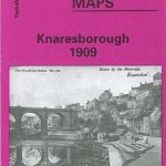 Knaresborough 1909
 Winchmore Hill 1896 – 7.10a
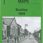 Buckley 1909
Govan 1909
Birkdale 1909 – 75.13
Buckley 1909
Govan 1909
Birkdale 1909 – 75.13
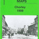 Chorley 1909
Hillhead 1909 – 6.06b
Blackrod 1907
Southport (North) 1909 – 75.06b
Wylde Green 1913
Chorley 1909
Hillhead 1909 – 6.06b
Blackrod 1907
Southport (North) 1909 – 75.06b
Wylde Green 1913
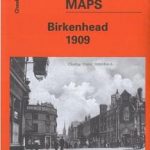 Birkenhead 1909 – 13.03b
Tranmere & Oxton 1909
Lostock Hall and Farington North 1909
Glasgow High Street 1909
Moss Valley and Gwersyllt 1909
Padiham 1909
Aldershot 1909
Wrexham West 1909
Birkenhead 1909 – 13.03b
Tranmere & Oxton 1909
Lostock Hall and Farington North 1909
Glasgow High Street 1909
Moss Valley and Gwersyllt 1909
Padiham 1909
Aldershot 1909
Wrexham West 1909
 Coed-Talon 1909
Barnsley 1904
Carmyle 1934
Rose Grove and Habergham 1909
Coed-Talon 1909
Barnsley 1904
Carmyle 1934
Rose Grove and Habergham 1909