Disclosure : This site contains affiliate links to products. We may receive a commission for purchases made through these links.
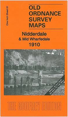
Nidderdale & Mid Wharfedale 1910 – 61

Related Products:
 Nidderdale Way
 Harrogate & Nidderdale
 Nidderdale and Ripon Walks
 Wensleydale & Upper Wharfedale OS Landranger 98
 Wensleydale and Upper Wharfedale 1852-1865
 Wensleydale & Upper Wharfedale OS Landranger 98 ACTIVE
 Wharfedale & Ilkley: Short Scenic Walks
 Nidderdale – Fountains Abbey, Ripon & Pateley Bridge OS Explorer Map 298 (paper)
 Lower Wharfedale & Washburn Valley – Harrogate & Ilkley Moor OS Explorer Map 297 (paper)
 Nidderdale – Fountains Abbey, Ripon & Pateley Bridge OS Explorer Active Map 298 (waterproof)
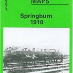 Springburn 1910 – 6.03b
 Mold 1910 – 13.08
 Lower Wharfedale & Washburn Valley – Harrogate & Ilkley Moor OS Explorer Active Map 297 (wateproof)
 Glasgow Green 1910 – 6.15b
 Glasgow (East End) 1910 – 6.12b
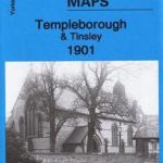 Templeborough & Tinsley 1910 – 289.14a
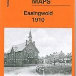 Easingwold 1910: Yorkshire Sheet 121.11
 The People: The Rise and Fall of the Working Class, 1910-2010
 Burnley 1910
Blackburn 1910
Burnley 1910
Blackburn 1910
 Fleetwood 1910
Bishopbriggs 1910
Cathcart 1910
Fleetwood 1910
Bishopbriggs 1910
Cathcart 1910
 Denbigh 1910
Ruthin 1910 – 19.07
Talwrn 1910
Minera 1910
Denbigh 1910
Ruthin 1910 – 19.07
Talwrn 1910
Minera 1910
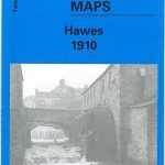 Hawes 1910
 Holywell 1910
 Goathland 1910 – 45.16
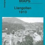 Llangollen 1910
Motherwell 1910 – 12.13b
Coatbridge 1910 – 7.12b
Llangollen 1910
Motherwell 1910 – 12.13b
Coatbridge 1910 – 7.12b
 Mitcham 1910
 Pollokshields 1910 – 6.14a
 Poulton-le-Fylde 1910 – 51.02
 Reeth and Grinton 1910
 Dyserth and Meliden 1910
Holytown & New Stevenston 1910 – 12.06
Dyserth and Meliden 1910
Holytown & New Stevenston 1910 – 12.06
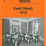 Ewell West 1910