Disclosure : This site contains affiliate links to products. We may receive a commission for purchases made through these links.
Redruth 1906
Redruth in 1906 in a fascinating series of reproductions of old Ordnance Survey plans in the Alan Godfrey Editions, ideal for anyone interested in the history of their neighbourhood or family. The map covers most of the town centre and the area to the south, extending from Fore Street southward to Church Coombe. Features in the town centre include station, Fore Street, West End, Chapel Street, Penryn Street, Station Hill, Jack Splat, Back Lane East, Albany Road, Clinton Road, Falmouth Road, Victoria Park, Sparnon, Fair Meadow, Trengweath House. The GWR main line runs through the map and part of the Tresavean Branch is shown. On the west side of the map are various hamlets: Carnbrea, Church Town, Church Coombe, part of Tarewaste. Other features include Redruth Workhouse, Wheal Uny, Wheal Union, Stream Works, South Carnbrea Mine, various old shafts. On the east side of the map a stretch of the Redruth & Chacewater Railway is shown; also Wheal Trefusis, Perseverance Mine, smelting works and Southgate Street. Extracts from a 1910 directory are on the reverse.About the Alan Godfrey Editions of the 25″ OS SeriesSelected towns in Great Britain and Ireland are covered by maps showing the extent of urban development in the last decades of the 19th and early 20th century. The plans have been taken from the Ordnance Survey mapping and reprinted at about 15 inches to one mile (1:4,340). On the reverse most maps have historical notes and many also include extracts from contemporary directories. Most maps cover about one mile (1.6kms) north/south, one and a half miles (2.4kms) across; adjoining sheets can be combined to provide wider coverage.FOR MORE INFORMATION AND A COMPLETE LIST OF ALL AVAILABLE TITLES PLEASE CLICK ON THE SERIES LINK.

Related Products:
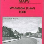 Whitstable East 1906
 St Ives 1906
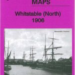 Whitstable (North) 1906 – 23.10
 Helston 1906
 Croydon East: Coombe Park & Addiscombe Road 1895 – 158
 Leeds South and South East 1906
Central Croydon 1895 – 14.10
Penryn 1906
Leeds South and South East 1906
Central Croydon 1895 – 14.10
Penryn 1906
 Central Leeds 1906 – 218.02b
 Bradford Central 1906
 Bradford East 1906
 Knotty Ash and Old Swan 1906
 Coombe and Norbiton 1911
Bodmin 1906
Coombe and Norbiton 1911
Bodmin 1906
 Holbeck & New Wortley 1906 – 218.05b
 Central Liverpool 1906 – 106.14b
 Liverpool North 1906
 Southampton (East) 1908 – 65.11a
Wadebridge 1906
Ipswich South-West 1902
Southampton (East) 1908 – 65.11a
Wadebridge 1906
Ipswich South-West 1902
 Kirkdale 1906
Ipswich 1902 – 75.11
Kirkdale 1906
Ipswich 1902 – 75.11
 Liverpool Toxteth 1906
Bridport 1901
Newton-le-Willows 1906
Liverpool Toxteth 1906
Bridport 1901
Newton-le-Willows 1906
 Uckfield 1908
 Bradford North 1906
Canterbury 1906 – 46.03
Aintree 1906
Bradford North 1906
Canterbury 1906 – 46.03
Aintree 1906
 Peebles 1906 – 13.06
Devonport North 1893
Peebles 1906 – 13.06
Devonport North 1893
 Downpatrick 1901
Swindon South-East 1899
Downpatrick 1901
Swindon South-East 1899
 Meanwood and Far Headingley 1906
Hindley Green 1906
Earlestown South 1906
Leicester (NE) 1913 – 31.11
Swindon (NE) 1899 – 15.04a
Cirencester East 1920
March Station 1900
Meanwood and Far Headingley 1906
Hindley Green 1906
Earlestown South 1906
Leicester (NE) 1913 – 31.11
Swindon (NE) 1899 – 15.04a
Cirencester East 1920
March Station 1900