Disclosure : This site contains affiliate links to products. We may receive a commission for purchases made through these links.
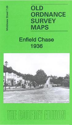
Enfield Chase 1936 – 7.06b

Related Products:
 Enfield (South) 1935 – 7.07b
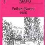 Enfield (North) 1935 – 7.03b
 We`re Going on an Elf Chase
 Brendon Chase
 Lightning Chase Me Home
 Cranborne Chase 1894 – 314
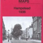 Hampstead 1936 – 27.4
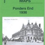 Ponders End 1936 – 7.08
 Magnus Chase and the Sword of Summer
 Where`s Wally? Incredible Paper Chase
 Cannock Chase & SE Staffordshire 1898 – 154
 Winchmore Hill 1936 – 7.10b
 Palmers Green 1936 – 7.14b
 Enniskillen (East) 1936 – 22.10
 Enniskillen (West) 1936 – 22.09
 Magnus Chase and the Ship of the Dead (Book 3)
 Shifty Mcgifty and Slippery Sam: the Diamond Chase
 Gospel Oak & Tufnell Park 1936 – 28.3
 Finsbury Park & Stroud Green 1936 – 20.4
 Old Benwell & Denton 1936: Tyneside Sheet 29
 Enfield (NW) 1911 – 7.02
 Enfield Highway 1911
 Enfield (South) 1895 – 7.07a
Enfield – Barnet London Boroughs
Enfield (South) 1895 – 7.07a
Enfield – Barnet London Boroughs
 Walks in the London Borough of Enfield – Volume 1
 Enfield (Forty Hill & Clay Hill) 1935 – 2.15
 North London Three Borough Challenge Walk – Enfield, Barnet and Haringey
 Cannock Chase
 A Wild Sheep Chase
 We`re Going on an Elf Chase: Board Book
 Highgate 1936 – 19.4
Tottenham 1936 – 13.4
Highgate 1936 – 19.4
Tottenham 1936 – 13.4
 London North: The City, West End, Enfield, Ealing, Harrow & Watford OS Explorer Map 173 (paper)
 Kenton and Wealdstone 1936
 Tottenham (North) 1936 – 8b
 Walthamstow West 1936 – 14.3
 London North: The City, West End, Enfield, Ealing, Harrow & Watford OS Explorer Active Map 173 (waterproof)
 Magnus Chase and the Hammer of Thor (Book 2)
 9 From the Nine Worlds: Magnus Chase and the Gods of Asgard
 Wilfred and Olbert`s Totally Wild Chase