Disclosure : This site contains affiliate links to products. We may receive a commission for purchases made through these links.
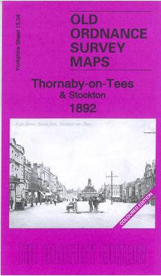
Thornaby-on-Tees & Stockton 1892 – 15.04 Coloured Edition

Related Products:
 Stockton-on-Tees & Thornaby 1914 – 50.16b
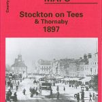 Stockton on Tees & Thornaby 1897 – 50.16a
 Middlesbrough – Stockton-on-Tees A-Z Street Atlas
 Middlesbrough & Hartlepool – Stockton-on-Tees & Redcar OS Explorer Map 306 (paper)
 Middlesbrough & Hartlepool – Stockton-on-Tees & Redcar OS Explorer Active Map 306 (waterproof)
 Birkdale 1892 – 75.13a Coloured Edition
 Hindley 1892 – 94.09a Coloured Edition
 Central Southport 1892 – 75.09a Coloured Edition
 Whalley Range 1892 – 111.02a Coloured Edition
 Leigh (North) 1892 – 102.03a Coloured Edition
 Leigh (South) 1892 – 102.07a Coloured Edition
 Guide Bridge & Dukinfield 1892 – 105.10a Coloured Edition
 Sheffield (Neepsend & Owlerton) 1892 – 294.03a Coloured Edition
 Blackburn 1892 (Coloured Edition)
 Sheffield (West) 1892 – 294.07a Coloured Edition
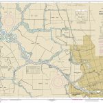 NOAA Chart 18663 – San Joaquin River’”Stockton Deep Water Channel’”Medford Island to Stockton
 Old Thornaby 1913 – 56.04
 Thornaby (Mandale & Teeside Park) 1913 – 16.01
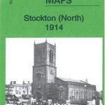 Stockton (North) 1914 – 50.12b
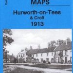 Hurworth-on-Tees & Croft 1913 – 57.02
 Outwood 1892 – 233.15
 St Helens SE 1892 – 108.01a
 Wigan 1892 – 93.08a
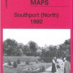 Southport (North) 1892 – 75.06a
 Halifax (NW) 1892: Yorkshire Sheet 230.08a
 Stockton (North) 1899 – 50.12a
 Admiralty Chart 2567 – Approaches to Tees Bay
 Admiralty Chart 152 – Tyne to River Tees
 Admiralty Chart 134 – River Tees to Scarborough
 Admiralty Chart 2566 – Tees and Hartlepool Bays
 NOAA Chart 16046 – McClure and Stockton Islands and Vicinity
 North York Moors, Tees Valley & Durham Coast Sustrans Cycle Map 33
Plymouth Hoe 1892
North York Moors, Tees Valley & Durham Coast Sustrans Cycle Map 33
Plymouth Hoe 1892
 Bolton 1890 – 87.13a Coloured Edition
 Middleton 1891 – 96.08a Coloured Edition
 Rotherham 1890 – 289.11a Coloured Edition
 Littleborough 1891 – 81.10 Coloured Edition
 Rochdale 1891 – 89.01a Coloured Edition
 Oldham 1891 – 97.06a Coloured Edition
 Toxteth 1890 – 113.02a Coloured Edition