Disclosure : This site contains affiliate links to products. We may receive a commission for purchases made through these links.
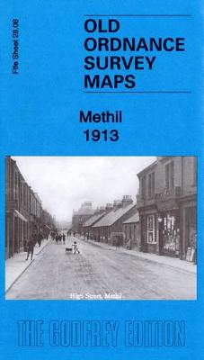
Methil 1913 – 28.08a

Related Products:
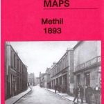 Methil 1893 – 28.08a
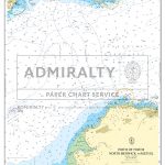 Admiralty Chart SC5615_11 – Firth of Forth North Berwick to Methil
 Dunfermline, Kirkcaldy & Glenrothes South – Methil & Culross OS Explorer Map 367 (paper)
 Dunfermline, Kirkcaldy & Glenrothes South – Methil & Culross OS Explorer Active Map 367 (waterproof)
 Heanor 1913 – 45.04
 Uxbridge 1913 – 14.03b
 Longbenton 1913 – 31
 Old Thornaby 1913 – 56.04
 Morriston 1913 – 15.09
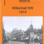 Willenhall SW 1913 – 62.12b
 Walsall (SW) 1913 – 63.10b
 Walsall (SE) 1913 – 63.11b
 Walsall (NW) 1913 – 63.06b
 Bilston 1913 – 62.16c
 Smethwick 1913 – 72.03b
 Derby (North) 1913 – 50.09b
 Derby (South) 1913 – 50.13b
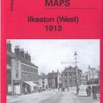 Ilkeston (West) 1913 – 46.13
 Gosforth 1913: Tyneside 30b
 Bristol (SW) & Bedminster 1913 – 75.04b
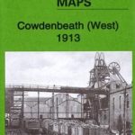 Cowdenbeath (West) 1913 – 34.11
 Cowdenbeath (East) 1913 – 34.12
 South Ealing 1913 – 70.3
 Darley Abbey 1913 – 50.05
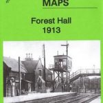 Forest Hall 1913 – 32
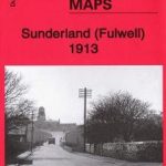 Sunderland (Fulwell) 1913 – 8.06
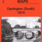 Darlington (South) 1913 – 55.10b
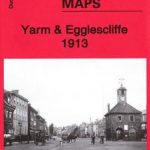 Yarm & Egglescliffe 1913 – 56.11
 Birmingham (East) 1913 – 14.06b
 Wakefield (North) 1913 – 248.03b
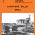 Wakefield (South) 1913 – 248.07b
 Middleton St George 1913 – 55.12
 Lofthousegate & Outwood 1913 – 233.11
 Central Nottingham 1913 – 42.02c
 Nottingham (South) 1913 – 42.06c
 Battersea & Fulham 1913 – 100.3
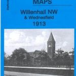 Willenhall (NW) & Wednesfield 1913 – 62.08b
 The Lower Mersey 1913 – 97
 Oldbury & Spon Lane 1913 – 68.14b
 Hartlepool & East Durham 1913 – 27