Disclosure : This site contains affiliate links to products. We may receive a commission for purchases made through these links.
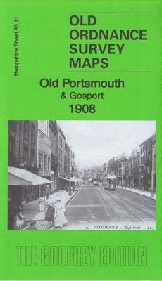
Old Portsmouth & Gosport 1908 – 83.11b
Related Products:
 Old Portsmouth & Gosport 1931 – 83.11c
 Old Portsmouth & Gosport 1896 – 83.11a
 Meon Valley, Portsmouth, Gosport & Fareham OS Explorer Map OL3 (paper)
 Meon Valley, Portsmouth, Gosport & Fareham OS Explorer Active Map OL3 (waterproof)
 Gosport (West) 1931 – 83.06
 NOAA Chart 13283 – Portsmouth Harbor’”Cape Neddick Harbor to Isles of Shoals – Portsmouth Harbor
 Central Portsmouth 1931 – 83.08c
 Central Portsmouth 1907 – 83.08b
 Portsmouth & Spithead 1893 – 331
 Portsmouth (Hilsea & Tipner) 1931 – 75.16
 Southampton – Portsmouth A-Z Street Atlas
 Portsea & Portsmouth Dockyard 1931 – 83.07c
 Alresford 1908 – 42.06
 Romsey 1908 – 56.04
 SW Montgomeryshire 1908 – 164
 Eastleigh (South) 1908 – 57.12a
 The Dark Peak 1908-13 – 86
 The Black Mountains 1908 – 214
 North Breconshire 1908 – 196
 Cromer & District 1908 – 131
 West Radnorshire 1908 – 179
 Fakenham & District 1908 – 146
 Eddystone & Salcombe 1908 – 354
 Ammanford & District 1908 – 230
 Merthyr & District 1908 – 231
 South Herefordshire 1908 – 215
 Smithy Bridge 1908 – 81.14
 Eastleigh (North) & Bishopstoke 1908 – 57.08a
 Rochdale (North) & Smallbridge 1908 – 81.13
 Dearne Valley & Barnsley 1908-13 – 87
 Watton – Swaffham & District 1908 – 160
 Monmouth – Wye & Forest of Dean 1908 – 233
 Aylsham – Reepham & District 1908 – 147
 Elmstead Wood & Mottingham Estate 1908
 Trevalga – Trevena & Tintagel Head 1894-1908 – 322
 Portsmouth A-Z Street Atlas
 Portsmouth A-Z Pocket Street Map
 Portsmouth: A Century of Change
 Portsmouth: A Pocket Miscellany
 Y35 Portsmouth Harbour and Approaches


