Disclosure : This site contains affiliate links to products. We may receive a commission for purchases made through these links.
Categories
-
Best Sellers
-

Tinos Anavasi 10.20
Tinos at 1:27,000 on a detailed, contoured, GPS compatible map from Anavasi with descriptions of 25 recommended hiking routes, printed on light, waterproof and tear-resistant synthetic Read More » -

Mr. Perfect
On a perfect summer`s day, Mr Perfect was looking more perfect than usual. His house was looking even more perfect than usual. That`s because it was Read More » -
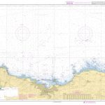
SHOM Chart 7120 – Abords de Cherbourg – Du Cap de La Hague ร la Pointe de Barfleur
PLEASE NOTE: the chart will be ordered for you if not currently in stock. Please allow 1-2 weeks for the chart to reach Stanfords. SHOM charts Read More » -

Donegal NW OSI Discovery 1
Map No. 1, Donegal North-West, in the Discovery series from OSI, the Ordnance Survey of Ireland, which presents the country on detailed topographic maps at 1:50,000, Read More » -

Europe General Map c.1900
A reproduction antique map of Europe circa 1900. Dissected and hand laid on cloth with a unique hand-made slip case.Paper maps are delicate things. Travellers from Read More » -

Kuohatti
The 1:50 000 topographic map gives a more general picture of the ground features than a basic map. It shows settlements, houses, roads, cultivated areas, waterways, Read More » -

Shah Abbas: The Ruthless King Who Became an Iranian Legend
Shah Abbas (1571-1629) was shah of Iran from 1588 (when he assumed power by deposing his father, whom he later murdered) until his death in 1629. Read More » -
Admiralty Chart 8015 – Rotterdam Port Approach Guide
NEW EDITION OUT ON 18/03/2021ADMIRALTY Port Approach Guides are single, port-scale charts that contain a wide range of planning information for some of the world`s busiest Read More » -

Lonesome Traveller
In `Lonesome Traveller` we join Jack Kerouac the enfant terrible of the Beat poets, as he roams the US, Mexico, Morocco, Paris and London, breathlessly recording Read More » -
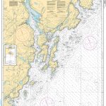
CHS Chart 4616 – Burin Harbours and Approches
The official Canadian charts provide an excellent range of scales for the whole length of Canada`s coastline as well as the Grat Lakes and comply with Read More »
-


