Disclosure : This site contains affiliate links to products. We may receive a commission for purchases made through these links.
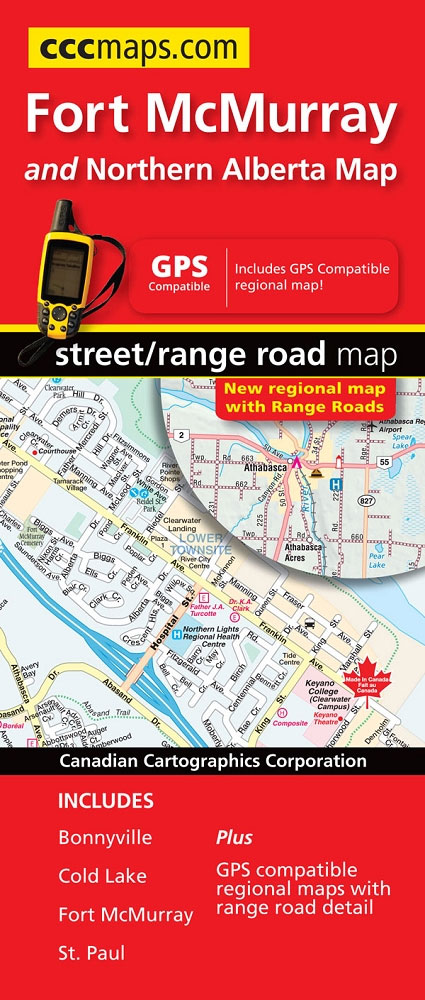
Fort McMurray AB

Related Products:
 Fort McMurray & Towns of Central and Northern Alberta
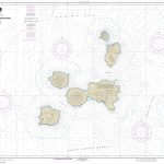
 NOAA Chart 18626 – Elk to Fort Bragg – Elk – Fort Bragg and Nayo Anchorage
 A Fort of Nine Towers
 Fort Meyers FL
 N`Djamena (Fort Lamy) IGN Map
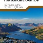
 Fort William and Glen Coe
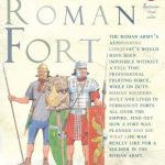 An Ancient Roman Fort
 Fort Worth TX Rand McNally
 Day Walks in Fort William & Glen Coe
 Moon Dallas & Fort Worth
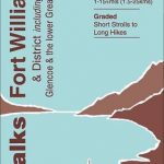 Walks Fort William & District
 Fort Lauderdale Metro FL Rand McNally
 Ben Nevis – Fort William & Glen Coe OS Landranger 41
 Fort William and Lochaber: 40 Favourite Walks
 Explore Fort William Map: Waterproof Map and Guide
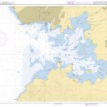
 Admiralty Chart 368 – Baie de Fort-de-France
 West Highland Way: Glasgow to Fort William
 Admiralty Chart 465 – Fort Liberte to Ile de la Tortue
 Moon Dallas & Fort Worth (Second Edition)
 Fort Myers – Cape Coral FL Rand McNally
 Dallas – Fort Worth Regional TX Rand McNally
 Ben Nevis – Fort William & Glen Coe OS Landranger 41 ACTIVE
 CHS Chart 5801 – Long Island to Fort George
 SHOM Chart 6892 – Baie de Fort-de-France
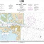 NOAA Chart 11475 – Fort Pierce Harbor
 SHOM Chart 6054 – Abords de Fort-Dauphin
 Ben Nevis, Fort William & Glen Coe OS Landranger Active Map 41 (waterproof)
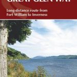 The Great Glen Way: Fort William to Inverness Two-Way Trail Guide
 The West Highland Way – 95 Mile Route Between Milngavie and Fort William
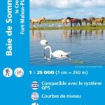 Baie de Somme – le Crotoy – Fort-Mahon-Plage IGN 2106ET
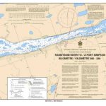 CHS Chart 6409 – Rabbitskin River to Fort Simpson Kilometre 300-330
CHS Chart 6410 – Fort Simpson to Trail River Kilometre 330-390
CHS Chart 6409 – Rabbitskin River to Fort Simpson Kilometre 300-330
CHS Chart 6410 – Fort Simpson to Trail River Kilometre 330-390
 Fodor`s South Florida: With Miami, Fort Lauderdale, and the Keys
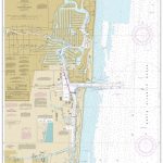 NOAA Chart 11470 – Fort Lauderdale’”Port Everglades
 SHOM Chart 6892L – Baie de Fort-de-France – Leisure A4 size
 Inverness, Loch Ness & Culloden – Fort Augustus & Drumnadrochit OS Explorer Map 416 (paper)
 Miami – Fort Lauderdale – West Palm Beach FL Regional Rand McNally
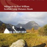 The West Highland Way: Milngavie to Fort William Scottish Long Distance Route
 Loch Arkaig – Fort William, Corpach – Gairlochy, Achnacarry & Kingie OS Explorer Map 399 (paper)
CHS Chart 6421 – Hardie Island to Fort Good Hope Kilometre 1040-1100
Loch Arkaig – Fort William, Corpach – Gairlochy, Achnacarry & Kingie OS Explorer Map 399 (paper)
CHS Chart 6421 – Hardie Island to Fort Good Hope Kilometre 1040-1100