Disclosure : This site contains affiliate links to products. We may receive a commission for purchases made through these links.
Mozambique Pocket Map
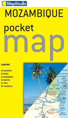
Mozambique Pocket Map at 1:2,500,000 from the South African publishers Map Studio, with street plans of central Maputo and Beira, plans of Inhambane, Vilankulo and Tofo, plus enlargements for the Inhambane area and the Bazaruto archipelago.On one side is an indexed map of the whole country, including most of Malawi, eastern Zimbabwe with Harare, Kruger National Park in South Africa and the whole of Swaziland. Road network indicates unsurfaced routes and locations of fuel supplies. Border crossings are annotated with opening times. Railway lines are shown with stations and local airfields are marked. National parks and other protected areas are prominently highlighted.The map indicates various places of interest, campsites and selected tourist accommodation. Topographic information is limited to lakes and rivers, marches and main peaks. The map is indexed and has latitude and longitude lines at intervals of 2ยฐ.On the reverse there are indexed street plans of central Maputo, Beira, Inhambane and Vilankulo, all annotated with places of interest, recommended hotels, etc. Also included is a plan of Tofo and enlargements for the Inhambane area and the Bazaruto archipelago, again annotated with accommodation, places of interest, etc. Further panels provide lists of useful contact details.


