Disclosure : This site contains affiliate links to products. We may receive a commission for purchases made through these links.
USA: Antenna Audio American Highway Road Atlas – A3, PAPERBACK
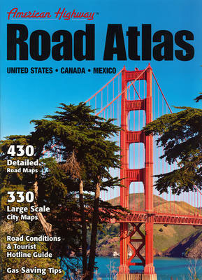
USA American Highway Road Atlas from Antenna Audio in an A3 paperback format, covering USA and southern Canada, with mapping of each state accompanied by enlargements from the overall selection of 330 city transit maps. The atlas also includes two pages covering Mexico at 1:6m approx, with six city transit maps and a distance table.Each state is shown on two pages, with larger state such as California or Texas covered on four pages. Scales vary according to the size of the state/province. Coverage of each state or Canadian province is conveniently accompanied by enlargements presenting its main cities on transit maps which show approach and transit routes plus selected main streets and places of interest, as well as by a distance table for locations within that state/province.The atlas presents the road network on a base with relief shading to indicate the topography, with peak heights and names of various mountain ranges. National and state/provincial parks or forests and other protected areas are prominently highlighted, with colouring also showing Indian reservations and restricted entry military areas. Road network, from free or toll highways to selected unpaved local roads clearly shows the road numbers, and indicates scenic routes, services, rest areas and wayside stops. Numerous places of interest are highlighted, including public campsites. The maps have no geographical coordinates. The index, arranged by state/province, in USA separately lists countries and cities/towns.Also provided are: an overview map of USA for route planning, a distance chart, a distance and driving times map, information on state speed limits and contact numbers for road conditions, a list of tourist information centres, plus petrol saving tips.PLEASE NOTE: Antenna Audio also published a reduced version USA Road Atlas in an A4 format, with smaller, less detailed road maps and city transit maps grouped together.


