Disclosure : This site contains affiliate links to products. We may receive a commission for purchases made through these links.
Categories
-
Best Sellers
-

Mantta-Vilppula
The 1:50,000 topographic map gives a more general picture of the ground features than a basic map. It shows settlements, houses, roads, cultivated areas, waterways, cutting Read More » -
Fodor`s Seattle
For a limited time, receive a free Fodor`s Guide to Safe and Healthy Travel e-book with the purchase of this guidebook! Go to fodors.com for details.Whether Read More » -

Climate Justice: Hope, Resilience, and the Fight for a Sustainable Future
Shortlisted for the Irish Book Awards 2018Holding her first grandchild in her arms in 2003, Mary Robinson was struck by the uncertainty of the world he Read More » -

Central Crete Terrain Editions 449
Central Crete at 1:100,000 on an indexed, GPS compatible road map from Terrain Editions, printed on light, waterproof and tear-resistant plastic paper, with street plans of Read More » -

Sharks Sticker Activity Book: Over 1,000 Stickers! (NG Sticker Activity Books)
Rule the ocean in this shark-tastic sticker and activity book from National Geographic Kids! This super engaging activity book is packed with mazes, spelling and pattern Read More » -

NGA Chart 61400 – Mozambique Channel-Northern Reaches
Produced by the US Government, National Geospatial-Intelligence Agency (NGA) charts provide information for the International Waters. They are printed on demand at our London shop and Read More » -

The World Stormrider Surf Guide
The biggest, most comprehensive, reference guide to the waves on “Planet Surf” The World Stormrider Surf Guide explores every dynamic surf zone known to man, from Read More » -
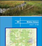
Central Veluwe
Central Veluwe on a waterproof, tear-resistant, GPS compatible walking map at 1:25,000 from Trage Paden, in a series of maps with extensive overprint for long-distance and Read More » -

Admiralty Chart 1151 – Bristol Channel, Bridgwater Bay
Admiralty standard nautical charts comply with Safety of Life at Sea (SOLAS) regulations and are ideal for professional, commercial and recreational use. Charts within the series Read More » -
CHS Chart 3601 – Juan de Fuca Strait to Vancouver Harbour
The official Canadian charts provide an excellent range of scales for the whole length of Canada`s coastline as well as the Grat Lakes and comply with Read More »
-


