Disclosure : This site contains affiliate links to products. We may receive a commission for purchases made through these links.
Medium Otter
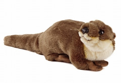
Cute and cuddly Otter soft toy with excellent detailing.Swing tag includes educational facts about the animal, its habitat and food.It carries the CE label so it safe for children.It is made to the highest standards from the finest materials (synthetic plush and filled with polyester fibre).

Related Products:
 Medium Brown Bear
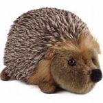 Medium Hedgehog
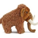 Medium Woolly Mammoth
 Small Sitting Fox
 Small Puffin
 Small Badger
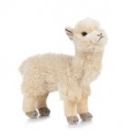 Alpaca
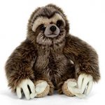 Large Sloth
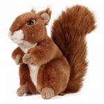
 Small Squirrel
 Large Squirrel
 Large Fox
 Large Chimp
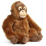 Large Orangutan
 Large Highland Cow
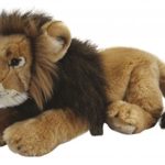 Large Lion
 Large Badger
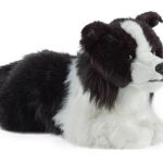 Large Collie
 Large Husky
 Large Tiger
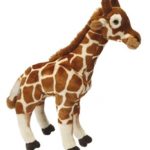 Large Giraffe
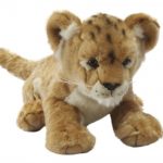 Large Lion Cub
 Small Fluffy Chick
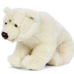 Large Polar Bear
 Large German Shepherd
 Large Cheetah
 Large Dutch Lop Eared Rabbit
 Living Nature Buddies: medium
Living Nature Buddies: small
Living Nature Buddies: large
Living Nature Buddies: medium
Living Nature Buddies: small
Living Nature Buddies: large
 Small Mole Sitting
 Gross and Ghastly: Animals: The Big Book of Disgusting Animal Facts
 Otter Country: In Search of the Wild Otter
 LEGO Animal Atlas: with four exclusive animal models
 Arctic Fox
 Cuddly Snowman
 Toddler Backpack – Owl
 Oscar Otter sticker book
 Baby Llama: Finger Puppet Book
 An Otter Called Pebble
 Baxter`s Book