Disclosure : This site contains affiliate links to products. We may receive a commission for purchases made through these links.
Waterford OSI Street Map

Related Products:
 Waterford SE OSI Discovery 82
 Discover Waterford
 Cork – Waterford OSI Discovery 81
Kilkenny – Tipperary – Waterford OSI Discovery 75
Carlow – Kilkenny – Waterford – Wexford OSI Discovery 76
Cork – Waterford OSI Discovery 81
Kilkenny – Tipperary – Waterford OSI Discovery 75
Carlow – Kilkenny – Waterford – Wexford OSI Discovery 76
 Cork – Limerick – Tipperary – Waterford Discovery 74
 Admiralty Chart 2046 – Waterford Harbour
 Admiralty Chart SC5622_2 – Waterford Harbour to Ballycotton Bay
 Admiralty Chart SC5621_2 – Waterford to Saint David`s Head
 ADMIRALTY Leisure Folio SC 5622 – Ireland South Coast, Waterford to Kinsale
 ADMIRALTY Leisure Folio SC 5621 – Ireland East Coast, Carlingford Lough to Waterford
 Admiralty Chart SC5621_17 – Entrance to Waterford Harbour – Dunmore East Harbour
 Admiralty Chart SC5622_3 – Entrance to Waterford Harbour – Dunmore East Harbour
 Admiralty Chart SC5621_15 – Wexford and Rosslare – Rosslare Europort – Waterford
 Constance Street: The True Story of One Family and One Street in London`s East End
 Buenos Aires Street de Dios Street Plan
 A Street Through Time: A 12,000 Year Journey Along the Same Street
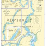 Admiralty Chart SC5622_4 – Passage East to Beacon Quay and Pink Point – Continuation of River Barrow to New Ross – Continuation of Queen`s Channel to Waterford – New Ross
 The Street Food Cook Book: Celebrating the Best Northern Street Food
 Mowgli Street Food: Stories and recipes from the Mowgli Street Food restaurants
 Academy Street
 Limerick OSI Street Map
 Last Stop on Market Street
 New York Street Food
 Hamburg High 5 Edition Street Plan
Greater Stockholm Norstedts Street Plan
Hamburg High 5 Edition Street Plan
Greater Stockholm Norstedts Street Plan
 Fitzrovia, The Other Side of Oxford Street: A Social History 1900-1950
 The Street
 Street Art
 New Street Art
Art of the Street
New Street Art
Art of the Street
 Nice IGN Street Map
 Shingle Street
 Maisy`s Street
 A Street Cat Named Bob
 Fleet Street
 Cork OSI Street Map
 Kilkenny OSI Street Map
 Reims IGN Street Map
Street Notes
Reims IGN Street Map
Street Notes