Disclosure : This site contains affiliate links to products. We may receive a commission for purchases made through these links.
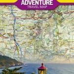
Canada West NGS Adventure Map 3113
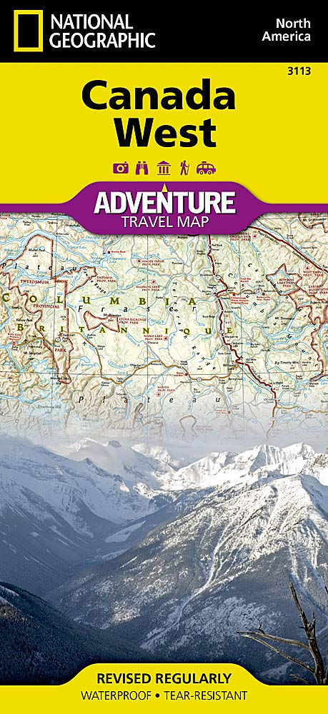
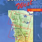
Western Canada in a series of three indexed, waterproof and tear-resistant road maps of the country with topographic and tourist information. The maps, published by Reise Know-How as part of their highly acclaimed World Mapping Project, are double-sided to provide the best balance between a good scale and a convenient size sheet. The area is divided north/south, with a good overlap between the two sides. Coverage on the north side extends beyond 70ยบ of latitude and 110ยบ of longitude to include the western end of the Northwest Passage and most of the Northwest Territories. The southern side extends eastwards to cover virtually all of Alberta with Calgary, Edmonton and the Banff and Jasper National Parks. The map has altitude colouring with spot heights and plenty of names of mountain and hill ranges, plateaux, peaks, passes, rivers and lakes. National and provincial parks and other protected areas are highlighted. Road network indicates unpaved sections of main and secondary routes, includes minor roads and tracks, and shows winter roads. Intermediate distances are given on main routes. Railway lines and ferry connections are also shown. Symbols mark locations of various places of interest including natural sites and UNESCO World Heritage areas, selected campsites and refuges, bird sanctuaries, ski areas, etc. The map has a grid with latitude and longitude at intervals of 2ยบ, plus an index of localities. Map legend includes English. *”World Mapping Project”* is an extensive series of maps at varying scales, aiming to provide coverage of countries and regions worldwide using clear, well presented cartography with both topographic and tourist information.*Sample of cartography:*Some elements of the cartography e.g. minor roads and contours are printed relatively faintly compared with other information such as major roads. Although clearly legible on the map, the lower contrast of these details has made them less obvious on the reproduction of the cartography presented here.

Related Products:
 Canada West Reise Know-How
 Canada East Reise Know-How
 India North and West ITMB
 India Northwest Reise Know-How
 South West Western Australia Hema
 Canada: Reise Know-How Regional Road Maps
 Australia West Reise Know-How
 Mid West Western Australia Hema
 Canada F&B
 Canada Central: Western Ontario, Manitoba, Saskatchewan Reise-Know-How Map
 Pacific Northwest NGS Adventure Map 3118
 Canada West
 Western USA – South Western Canada Michelin Regional 585
 Canada Marco Polo Map
 Finland West Karttakeskus Road Map
 Africa West – Coastal Countries Reise Know-How
 Mexico NGS Adventure Map 3108
 Los Padres National Forest West CA
 Buffalo National River West AR
 Africa South & Central ITMB
 USA – Southern Canada Marco Polo Road Atlas A4 SPIRAL-BOUND
 Svalbard North-West
 Western Canada MapArt
 USA Northwest – OR, WA Reise Know-How
 Superior National Forest – Boundary Waters West MN
 South West Coast Path 1 – North Devon & Somerset A-Z Adventure Atlas
 Chile NGS Adventure Map 3402
 Prince William Sound West AK NGS Trails Illustrated Map 761
 Canada: ITMB/Canada Map Office Topographic Maps of British Columbia and the Rockies
 Canada West Hallwag Road Map
 Peru Reise Know-How
 Vietnam North NGS Adventure Map 3015
 Canada MapArt
 Perth & the South West – 4WD + Camping Escapes Atlas & Guide A4 SPIRAL-BOUND
 Crimea Reise Know-How
 Africa West – Sahara Reise Know-How
 India South Adventure Map
 Italy North Reise Know-How
 USA West
 Norway K+F Road Map